

Africa 1909, Edward Hertslet (Map of Africa by treaty, 3rd edition)
Map of Africa by the late Sir E. Hertslet, 3d ed., printed for H. M. Stationery off., by Harrison and sons, 1909. Note on verso: Although assistance is given towards this compilation from public funds on the ground of its general utility, it must be understood that it is not an official publication
- Date
- 1909
- Mapmaker / publisher
- Hertslet, Edward, Sir, 1824-1902
- Place
- Africa
- Archive
- Library of Congress (via Wikimedia Commons)
- Type
- map
- Original size
- 8,776 × 9,562 pixels
Public domainsafest
Reason: its maker died more than 100 years ago.
Read from: Commons licence category: PD-old-100-expired; no CC BY, CC BY-SA, GFDL or deletion tag on the file page.
Credit line
"Africa 1909, Edward Hertslet (Map of Africa by treaty, 3rd edition)" (1909). Hertslet, Edward, Sir, 1824-1902. Library of Congress, Geography and Map Division, via Wikimedia Commons. Public domain. https://commons.wikimedia.org/wiki/File:Africa_1909,_Edward_Hertslet_(Map_of_Africa_by_treaty,_3rd_edition).jpgNeed maps for a whole project? Add Find Any Map to Claude and ask for this one by its id: 7475.
More like this

The map of Africa by treaty
1909 · 39 sheets

Africa 1909, Edward Hertslet (Horn of Africa, detail)
1909 · Library of Congress

Stanford's library Map of Africa
1896 · Wikimedia Commons
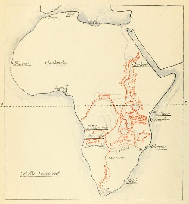
Les explorations du Sud et du Centre africains jusquen 1876
1913 · Wikimedia Commons

Afrique / dressée par E. Levasseur,.; avec le concours de C. Bagge
1890 · Wikimedia Commons

Africa 1909, Edward Hertslet (Lado enclave, detail)
1909 · Library of Congress

Map of Northern Africa, showing present political divisions and principal caravan routes
1909 · Wikimedia Commons

Andrees allgemeiner Handatlas: in 147 Haupt- und 163 Nebenkarten auf 223 Kartenseiten nebst vollständigem alphabetischem Namenverzeichnis
Wikimedia Commons