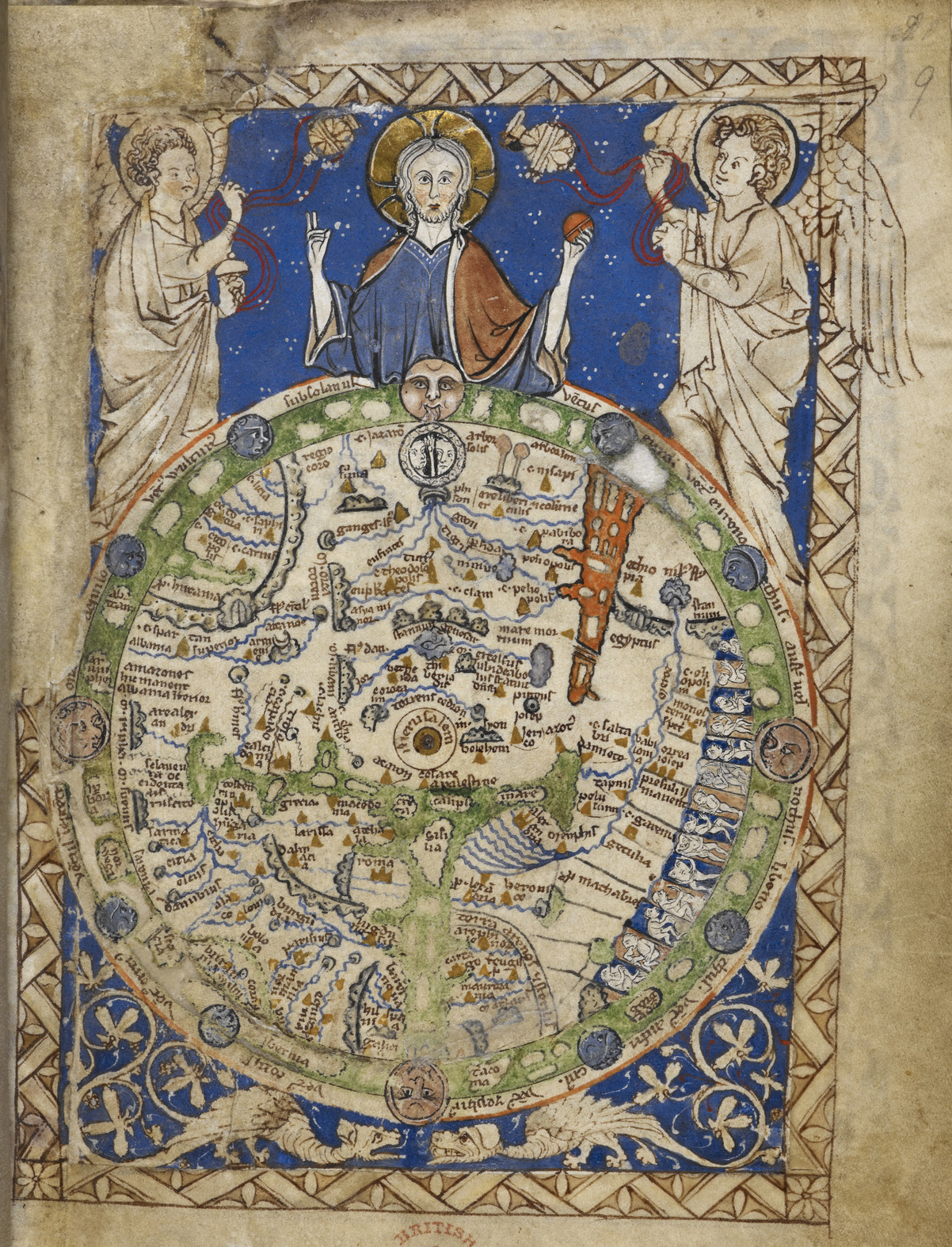

A map of the world - Latin Psalter (13th-15th C), f.9 - BL Add MS 28681
A round map of the world, set in a square ornamental frame, Jerusalem being in the centre, with a zone of winds, figures of inhabitants, etc. East is at top, the Red Sea is shown in red at upper right.
- Archive
- Wikimedia Commons
- Type
- map
- Original size
- 1,202 × 1,574 pixels
CC0safest
Reason: CC0: dedicated to the public domain.
Read from: Commons licence category: CC-Zero; no CC BY, CC BY-SA, GFDL or deletion tag on the file page.
Credit line
"A map of the world - Latin Psalter (13th-15th C), f.9 - BL Add MS 28681". Wikimedia Commons. CC0. https://commons.wikimedia.org/wiki/File:A_map_of_the_world_-_Latin_Psalter_(13th-15th_C),_f.9_-_BL_Add_MS_28681.jpgNeed maps for a whole project? Add Find Any Map to Claude and ask for this one by its id: 145366.
More like this

Psalter Mappa mundi
1200–1250 · Wikimedia Commons

Psalter world map
1200–1250 · Wikimedia Commons

Ca. 1277 World Map
1277 · Wikimedia Commons

Psalter map center jerusalem
c. 1260 · Wikimedia Commons

Abbo of Fleury, Map of the world
1833 · Wikimedia Commons

Psalter mappamundi
Wikimedia Commons

The mid 15th-century Catalan centered on Jerusalem
1300–1460 · Wikimedia Commons

Mappemonde-Liber-floridus-BNF-fo-45
1260 · Wikimedia Commons