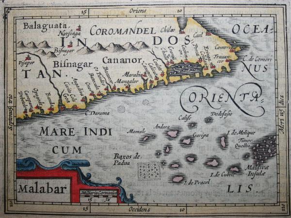

A horizontal Malabar Coast miniature, a reprint by Petrus Bertius, 1630
A horizontal Malabar Coast miniature map by Abraham Ortelius, Antwerp, c.1580, from the Epitome Theatri Orteliani; *a reprint by Petrus Bertius, 1630*; and *another Bertius version*, Amsterdam, c.1600-18
- Date
- 1630
- Mapmaker / publisher
- Petrus Bertius
- Place
- India
- Archive
- Wikimedia Commons
- Type
- map
- Original size
- 600 × 449 pixels
Public domainsafest
Reason: its maker died more than 100 years ago.
Read from: Commons licence category: PD-old-100-expired; no CC BY, CC BY-SA, GFDL or deletion tag on the file page.
Credit line
"A horizontal Malabar Coast miniature, a reprint by Petrus Bertius, 1630" (1630). Petrus Bertius, via Wikimedia Commons. Public domain. https://commons.wikimedia.org/wiki/File:A_horizontal_Malabar_Coast_miniature,_a_reprint_by_Petrus_Bertius,_1630.jpgNeed maps for a whole project? Add Find Any Map to Claude and ask for this one by its id: 255171.
More like this

A horizontal Malabar Coast miniature map by Abraham Ortelius, Antwerp, c.1580
1580 · India

Another Bertius version of A horizontal Malabar Coast miniature c.1600-18
1600 · Wikimedia Commons

A map by Petrus Bertius, Amsterdam, 1606
1606 · Wikimedia Commons
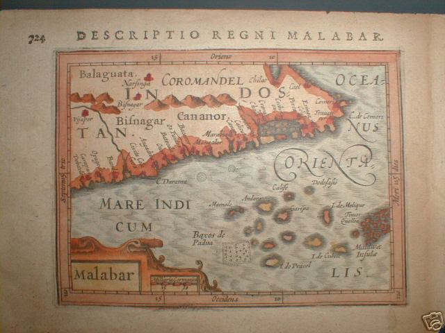
A horizontal Malabar Coast miniature map by Abraham Ortelius, Antwerp, c.1580, from the Epitome Theatri Orteliani
1580 · Kerala

The Malabar Coast, from 'The True and Exact Description of the Most Celebrated East-India Coast of Malabar and Choromandel as also of the Island of Ceylon' by Philip Baldaeus, 1744 (first printed in 1672)
1744 · Wikimedia Commons

Abraham Ortelius' miniature map of Southeast Asia issued in L'épitome du théatre de l'univers published by Jan Keerbergen to rival that of Philips Galle. It is a direct copy of Galle's but Keerbergen
1601 · Wikimedia Commons

A large draught of the MALLABAR COAST from bassalore to cape comaroone; Atlases, gazetteers, guidebooks and other books / The sea-atlas: containing an hydrographical description of most of the sea-coa
1702–1707 · New York Public Library

A miniature, colored, engraved map attributed to Abraham Ortelius. It shows mainly India and Southeast Asia set within Italian letterpress text.
1596–1640 · Wikimedia Commons