

19s Bengal province map
1910s skeleton map of Bengal province (based on 1911 census)
- Date
- 1917
- Mapmaker / publisher
- & T. H. Holland (general editor)
- Place
- Birbhum district
- Archive
- Wikimedia Commons
- Type
- map
- Original size
- 1,080 × 1,080 pixels
Public domainsafest
Reason: its maker died more than 70 years ago.
Read from: Commons licence category: PD-old-70-expired; no CC BY, CC BY-SA, GFDL or deletion tag on the file page.
Credit line
"19s Bengal province map" (1917). & T. H. Holland (general editor), via Wikimedia Commons. Public domain. https://commons.wikimedia.org/wiki/File:19s_Bengal_province_map.jpgNeed maps for a whole project? Add Find Any Map to Claude and ask for this one by its id: 256420.
More like this

Bihar and Orissa province
1912 · Wikimedia Commons

Map of Bengal districts 1943
1945 · Wikimedia Commons

Birbhoom and Bissunpour (1776 map by James Rennell)
1776 · Wikimedia Commons

Bengal gazetteer 1907-9
1907 · Wikimedia Commons

The Sketch Map Showing Provincial and District Divisions to Accompany the Administration Report, 1872–73 (Cropped to Bihar, Chota Nagpur, and Odisha)
1873 · Wikimedia Commons

Bankura district map 1908
1908 · Wikimedia Commons

Manbhum district in 1901
1907 · Wikimedia Commons
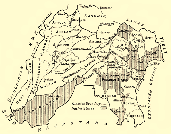
Punjab-Districts 1911
1913 · Wikimedia Commons