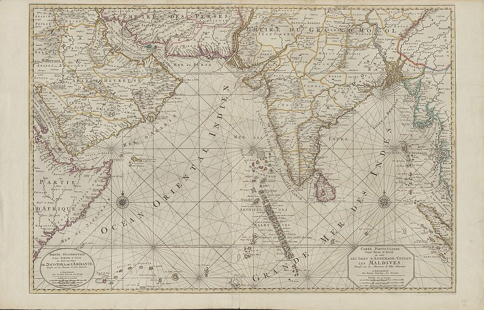

18th-century Maldives map by Pierre Mortier
This detail from an 18th-century map by Pierre Mortier of The Netherlands names several dozen of the Maldive Islands off the southwestern coast of India. Map title: Carte particuliere d'une partie d'Asie ou sont les Isles d'Andemaon, Ceylan, les Maldives: dressé sur les memoires le plus nouveaux.
- Date
- c. 1700
- Mapmaker / publisher
- Pierre Mortier of The Netherlands
- Place
- Asia
- Archive
- Wikimedia Commons
- Type
- map
- Original size
- 971 × 623 pixels
Public domainsafest
Reason: its maker died more than 100 years ago.
Read from: Commons licence category: PD-old-100-expired; no CC BY, CC BY-SA, GFDL or deletion tag on the file page.
Credit line
"18th-century Maldives map by Pierre Mortier" (c. 1700). Pierre Mortier of The Netherlands, via Wikimedia Commons. Public domain. https://commons.wikimedia.org/wiki/File:18th-century_Maldives_map_by_Pierre_Mortier_(cropped).jpgNeed maps for a whole project? Add Find Any Map to Claude and ask for this one by its id: 239391.
More like this

Map of Ceylon and the Maldives
c. 1705 · Wikimedia Commons

Maldivische eylanden, Mallabaar, Madure, Ceylon
Wikimedia Commons

A horizontal Malabar Coast miniature map by Abraham Ortelius, Antwerp, c.1580
1580 · India

From a very detailed map by J. Covens and C. Mortier
1740 · Wikimedia Commons

From "Nova tabula terrarum Cucan, Canara, Malabaria, Madura & Coramandelia, cum parte septroniali insulae Ceylon, in Mari Indico Orientali" by Gerard van Keulen, Amsterdam, c.1704
1704 · South India

1920 Maldives map BPL 12595 detail
1920 · Wikimedia Commons

From a map of South and Southeast Asia by Frederico de Wit, Amsterdam, c.1790
1790 · Wikimedia Commons

From "Nova tabula terrarum Cucan, Canara, Malabaria, Madura & Coramandelia, cum parte septroniali insulae Ceylon, in Mari Indico Orientali" by Gerard van Keulen, Amsterdam, c.1704 a
1704 · Sri Lanka