

15thcenturyhispaniola v2
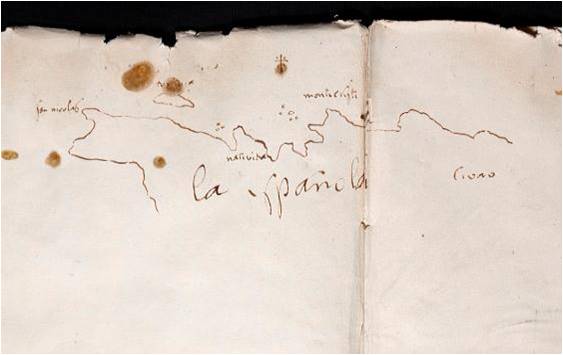
Italian map of Hispaniola.
- Date
- 1606
- Mapmaker / publisher
- Giovanni Battista Ramusio Original uploaders: Electionworld & DO'Neil (modifications: Suaheli)
- Place
- Hispaniola
- Archive
- Wikimedia Commons
- Type
- map
- Original size
- 3,343 × 2,219 pixels
Public domainsafest
Reason: its maker died more than 100 years ago.
Read from: Commons licence category: PD-old-100-expired; no CC BY, CC BY-SA, GFDL or deletion tag on the file page.
Credit line
"15thcenturyhispaniola v2" (1606). Giovanni Battista Ramusio Original uploaders: Electionworld & DO'Neil (modifications: Suaheli), via Wikimedia Commons. Public domain. https://commons.wikimedia.org/wiki/File:15thcenturyhispaniola_v2.JPGNeed maps for a whole project? Add Find Any Map to Claude and ask for this one by its id: 293781.
More like this

1565 Hispaniola Ramusio Delle Navigationi vol3 p44
1565 · Plate 44

1528 - Bordone - BNF - Spagnola
1528 · Wikimedia Commons

1534 - Isolario di Benedetto Bordone - Spagnola
1534 · Wikimedia Commons

Hispaniola
Wikimedia Commons

Isola Spagnuola
1556 · Wikimedia Commons

First map of the Spanish island by Pedro Mártir de Anglería
1511 · Wikimedia Commons
La Española 1493
c. 1493 · Wikimedia Commons

Waldseemuller map Caribbean
Wikimedia Commons