

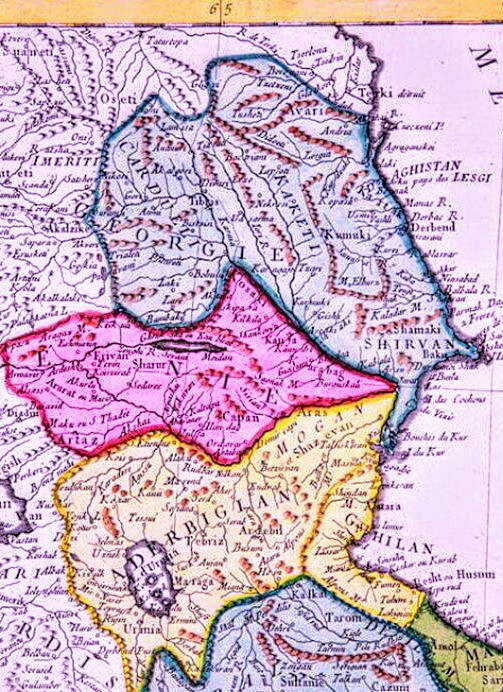
نقشه آذربایجان و اران
Old map of Azerbaijan from the book Sur-ul-Baladan
- Date
- May 16, 1274
- Mapmaker / publisher
- Mahdi6756
- Place
- Azerbaijan
- Archive
- Wikimedia Commons
- Type
- map
- Original size
- 1,512 × 1,920 pixels
CC0safest
Reason: CC0: dedicated to the public domain.
Read from: Commons licence category: CC-Zero; no CC BY, CC BY-SA, GFDL or deletion tag on the file page.
Credit line
"نقشه آذربایجان و اران" (May 16, 1274). Mahdi6756, via Wikimedia Commons. CC0. https://commons.wikimedia.org/wiki/File:%D9%86%D9%82%D8%B4%D9%87_%D8%A2%D8%B0%D8%B1%D8%A8%D8%A7%DB%8C%D8%AC%D8%A7%D9%86_%D9%88_%D8%A7%D8%B1%D8%A7%D9%86.pngNeed maps for a whole project? Add Find Any Map to Claude and ask for this one by its id: 144616.
More like this

Istakhri's map of the Mediterranean
Wikimedia Commons

Bahre fars (Cropped, Retouched, Rotated)
Wikimedia Commons

Mapa do Magreb, al-Istakhrī (c. 934)
Wikimedia Commons

Bahre Fars
Wikimedia Commons

Bahr-e Fars
Wikimedia Commons

Mapa do Magreb de Istakhrī
Wikimedia Commons
ARTAZ L' EMPIRE De PERSE 1779 d’Anville P.Santini ~3
1779 · Wikimedia Commons

Mamaliki-iran-muteferrika (Iran under the Safavid Empire- 1674-1745)
1736 · Wikimedia Commons