

Yazoo Expedition 5 March 1864
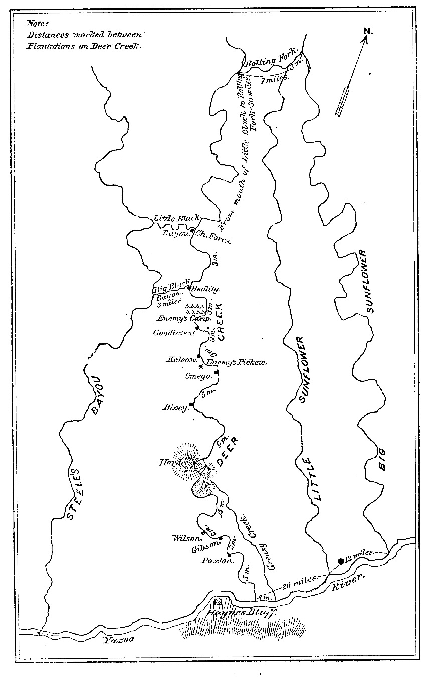
Map of the Yazoo Expedition, March 5, 1864.
- Date
- 1891
- Mapmaker / publisher
- The author of the map is not stated
- Archive
- Wikimedia Commons
- Type
- map
- Original size
- 465 × 787 pixels
Public domainsafest
Reason: a US government work.
Read from: Commons licence category: PD US Government; no CC BY, CC BY-SA, GFDL or deletion tag on the file page.
Credit line
"Yazoo Expedition 5 March 1864" (1891). The author of the map is not stated, via Wikimedia Commons. Public domain. https://commons.wikimedia.org/wiki/File:Yazoo_Expedition_5_March_1864.jpgNeed maps for a whole project? Add Find Any Map to Claude and ask for this one by its id: 950.
More like this

Map showing the route followed by the Union Navy vessels in the Steele's Bayou Expedition of the American Civil War, March 1863.
March 1863 · Wikimedia Commons

Route of the late expedition commanded by Act'g. Rear Admiral D. D. Porter U.S.N. attempting to get into the Yazoo River by the way of Steels Bayou and Deer Creek
April 1, 1863 · Library of Congress

Map of operations of the Yazoo Pass expedition under command of Lt. Com. Watson Smith, U.S.N., 1863.
1863 · Library of Congress

Route of the Yazoo Pass Expedition from the Yazoo Cut into the Coldwater River. Part of the Vicksburg Campaign of the American Civil War.
February 2, 1863 · Wikimedia Commons
Map of the area affected by the Steele's Bayou Expedition of the American Civil War, March 1863, with emphasis on locations of Confederate defenses.
March 1863 · Wikimedia Commons

Map showing the route of the late expedition, commanded by Rear Admiral Porter, U.S.N., in attempting to get into the Yazoo River by the way of Steel's Bluff (i.e., Bayou) and Deer Creek.
1863 · Library of Congress

Opposing forces near Greenwood, Mississippi, in the Yazoo Pass Expedition of the American Civil War (March 1863).
February 8, 2010 · Wikimedia Commons

1st Vicksburg Campaign 001
1862 · Wikimedia Commons