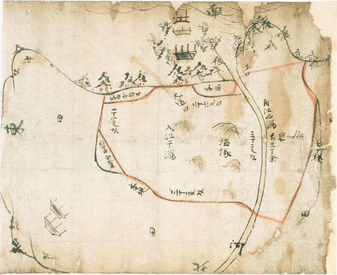

長門国正吉郷入江塩浜絵図 (Yamaguchi Prefectural Archives)
Late Kamakura period map showing salt fields in Nagato Province, Yamaguchi Prefectural Archives, Yamaguchi, Yamaguchi, Japan; Important Cultural Property
- Date
- c. 1327
- Mapmaker / publisher
- Kamakura-period brushman
- Place
- Japan
- Archive
- Wikimedia Commons
- Type
- map
- Original size
- 1,131 × 922 pixels
Public domainsafest
Reason: its maker died more than 100 years ago, and a faithful scan of a flat work adds no new copyright.
Read from: Commons licence category: PD-Art (PD-old-100); no CC BY, CC BY-SA, GFDL or deletion tag on the file page.
Credit line
"長門国正吉郷入江塩浜絵図 (Yamaguchi Prefectural Archives)" (c. 1327). Kamakura-period brushman, via Wikimedia Commons. Public domain. https://commons.wikimedia.org/wiki/File:%E9%95%B7%E9%96%80%E5%9B%BD%E6%AD%A3%E5%90%89%E9%83%B7%E5%85%A5%E6%B1%9F%E5%A1%A9%E6%B5%9C%E7%B5%B5%E5%9B%B3_(Yamaguchi_Prefectural_Archives).jpgNeed maps for a whole project? Add Find Any Map to Claude and ask for this one by its id: 257735.
More like this

Map Dividing the Hiokikitagō Estate in Satsuma (From the Shimazu family's collction of documents)
1324 · Wikimedia Commons

Pictorial Map of Engaku-ji Precincts (Shihon Tansai Engakuji Keidai Ezu)
1791 · Wikimedia Commons

Map of Japan (Jotokuji Fukui)
1568–1600 · Wikimedia Commons

Genroku Kuniezu - Ryūkyū Kingdom - Yaeyama Islands (National Archives of Japan)
1696 · Wikimedia Commons

Genroku Kuniezu - Ryūkyū Kingdom - Okinawa Island+ (National Archives of Japan)
1696 · Wikimedia Commons

Dai Nihon enkai yochi zenzu
1800 · 13 sheets

Complete map of salt fields in Fujian Province
1746 · Wikimedia Commons

Map of Japan known as Keichō Nihon sōzu (general map of Japan (compiled from data) of the Keichō era); the castle proprietor names reflect the situation as of c.1654, but otherwise the map is as of se
c. 1654 · Wikimedia Commons