

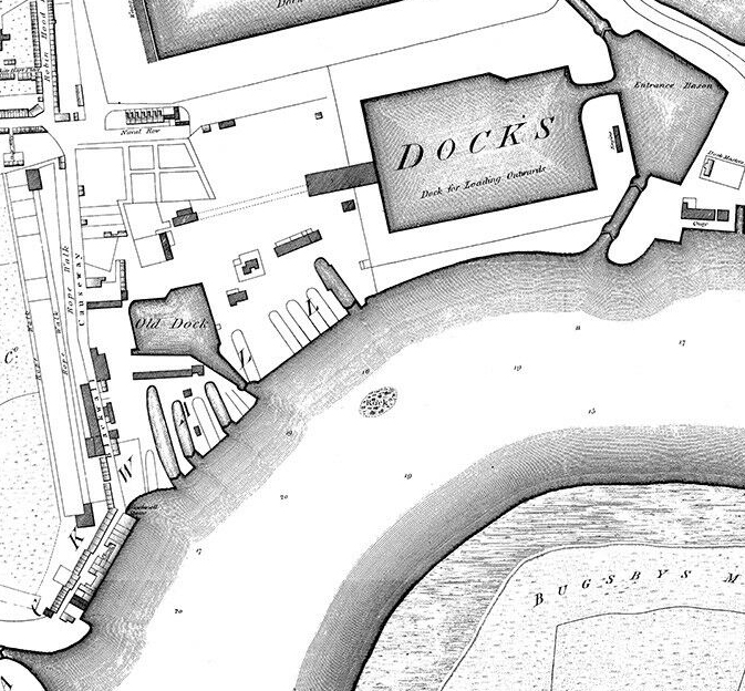
Woolwich, Powis Estate, 1825
Map of the Powis Estate (Powis Street, Bathway Quarter), Woolwich, south east London, 1825. Collection of The National Archives).
- Date
- 1825
- Mapmaker / publisher
- cartographer, 1821
- Place
- London
- Archive
- Wikimedia Commons
- Type
- map
- Original size
- 1,418 × 1,721 pixels
Public domainsafest
Reason: its US copyright has expired (published before 1931).
Read from: Commons licence category: PD US expired; no CC BY, CC BY-SA, GFDL or deletion tag on the file page.
Credit line
"Woolwich, Powis Estate, 1825" (1825). cartographer, 1821, via Wikimedia Commons. Public domain. https://commons.wikimedia.org/wiki/File:Woolwich,_Powis_Estate,_1825.jpgNeed maps for a whole project? Add Find Any Map to Claude and ask for this one by its id: 291786.
More like this

Woolwich, Beresford Square, Ordnance Survey Map, 1853
1853 · Wikimedia Commons

The Limehouse end of the Limehouse Cut c.1800
1799 · Wikimedia Commons

Limehouse Cut at the beginning of the 19th century
1809 · Wikimedia Commons

Shipyards at Deptford and Rotherhithe - Horwood’s map of London (1792-99)
1792–1799 · Wikimedia Commons

London South East Vol. J: sheet 25
1897 · Wikimedia Commons

London South East Vol. J: sheet 21
1897 · Wikimedia Commons
Horwood Blackwall
1813 · Wikimedia Commons

Limehouse basins 1819
1819 · Wikimedia Commons