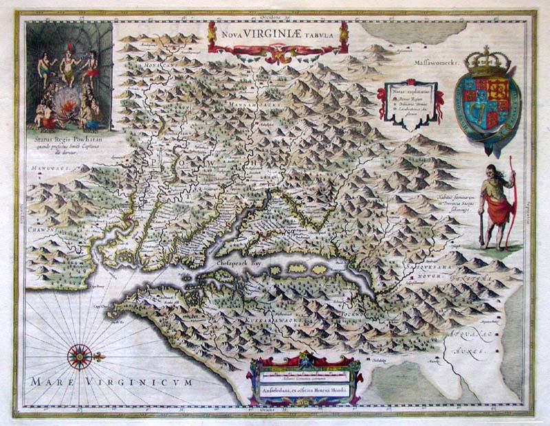

Virginia 1612 map
1612 map of Virginia, eastern North America. *This map was based on John Smith's 1612 map of the Virginia Colony, and was colored in by Henricus Hondius in 1639.
- Date
- 1639
- Mapmaker / publisher
- John Smith, Henricus Hondius
- Archive
- Wikimedia Commons
- Type
- map
- Original size
- 800 × 620 pixels
Public domainsafest
Reason: its maker died more than 100 years ago, and a faithful scan of a flat work adds no new copyright.
Read from: Commons licence category: PD-Art (PD-old-100); no CC BY, CC BY-SA, GFDL or deletion tag on the file page.
Credit line
"Virginia 1612 map" (1639). John Smith, Henricus Hondius, via Wikimedia Commons. Public domain. https://commons.wikimedia.org/wiki/File:Virginia_1612_map.jpgNeed maps for a whole project? Add Find Any Map to Claude and ask for this one by its id: 145184.
More like this

Nova Virginiae tabvla
1642 · Library of Congress

Relief shown pictorially. Facsimile. Original version: London: Printed by J.H. for T. Slater, 1629. 10th state of map, rev. 1624. Appears in: The true travels, adventures, and observations of Captaine
1819 · Library of Congress

Sixth state. Relief shown pictorially. Oriented with north to the right. Accompanied by 2 exhibit notes and LC jacket note.
1624 · Library of Congress

Relief shown pictorially. This map was issued with but not integral to Historia mundi, and is either inserted or pasted in some copies, appearing in various locations in the text. Phillips, 451 Philli
1636 · Library of Congress

drawing, print study, map
1585–1593 · Wikimedia Commons

Nova Virginiæ tabula.
1644 · Library of Congress

Scale ca. 1:1,320,000. Facsimile. Tenth state. Relief shown pictorially. Oriented with north to the right. "Captain John Smith's map of Virginia 1607." AACR2
1906 · Library of Congress

Scale ca. 1:1,290,000. Facsimile. Tenth state. Relief shown pictorially. Oriented with north to the right. "Captain John Smith's map of Virginia 1606." AACR2
1900 · Library of Congress