

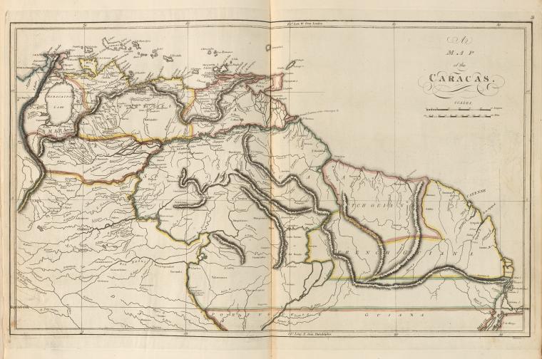
Venezuela and Dutch Guiana
Map between 1760 and 1839, NYPLDigitalGallery Matthew Carey; M. Carey
- Date
- 1760
- Mapmaker / publisher
- ( Publisher), Warnicke, John G. -- (Engraver)
- Place
- Venezuela
- Archive
- Wikimedia Commons
- Type
- map
- Original size
- 643 × 613 pixels
CC0safest
Reason: CC0: dedicated to the public domain.
Read from: Commons licence category: CC-Zero; no CC BY, CC BY-SA, GFDL or deletion tag on the file page.
Credit line
"Venezuela and Dutch Guiana" (1760). ( Publisher), Warnicke, John G. -- (Engraver), via Wikimedia Commons. CC0. https://commons.wikimedia.org/wiki/File:Venezuela_and_Dutch_Guiana.jpgNeed maps for a whole project? Add Find Any Map to Claude and ask for this one by its id: 306165.
More like this

Map of Spanish Guiana (Venezuela) and Dutch and French Guiana in 1814
1814 · New York Public Library
Map of venezuela(1760-1839)
1794–1839 · New York Public Library

Venezuela and British Guiana in 1826
1826 · Wikimedia Commons

Caracas and Guiana
1814 · Wikimedia Commons

Mapa de Venezuela, la Guayana Británica, la Guayana Holandesa y la Guayana Francesa cerca de 1821
1821 · Wikimedia Commons

Carte de la capitainerie générale de Caracas, comprenant les provinces de Venezuela, Maracaibo, Varinas, Cumana, la Guiane et l'ile de la Marguerite, pour servir au Voyage à la partie orientale de la Terre ferme dans l'Amérique méridionale / fait en 1801, 1802, 1803 et 1804 par F. de Pons; Dressée
1805 · Wikimedia Commons

A map of Caracas.
1814 · New York Public Library

Mapa de una parte de la America Meridional en que se manifiestan los paises pertenecientes al Nuebo Reyno de Granada y Capitania General de Caracas de los dominios de nuestro muy augusto soberano que
1783 · Library of Congress