

US ARMY MARYLAND CAMPAIGN MAP 3 (SOUTH MOUNTAIN)
Maryland Campaign: 14 September 1862 (South Mountain).
- Date
- May 31, 2016
- Mapmaker / publisher
- United States Army Center of Military History
- Archive
- Wikimedia Commons
- Type
- map
- Original size
- 1,370 × 1,864 pixels
Public domainsafest
Reason: a US government work (US Army).
Read from: Commons licence category: PD US Army; no CC BY, CC BY-SA, GFDL or deletion tag on the file page.
Credit line
"US ARMY MARYLAND CAMPAIGN MAP 3 (SOUTH MOUNTAIN)" (May 31, 2016). United States Army Center of Military History, via Wikimedia Commons. Public domain. https://commons.wikimedia.org/wiki/File:US_ARMY_MARYLAND_CAMPAIGN_MAP_3_(SOUTH_MOUNTAIN).jpgNeed maps for a whole project? Add Find Any Map to Claude and ask for this one by its id: 1301.
More like this

US ARMY MARYLAND CAMPAIGN MAP 2
May 31, 2016 · Wikimedia Commons

US ARMY MARYLAND CAMPAIGN MAP 5 (ANTIETAM)
May 31, 2016 · Wikimedia Commons

US ARMY MARYLAND CAMPAIGN MAP 4 (ANTIETAM)
May 31, 2016 · Wikimedia Commons

US ARMY MARYLAND CAMPAIGN MAP 1
May 31, 2016 · Wikimedia Commons
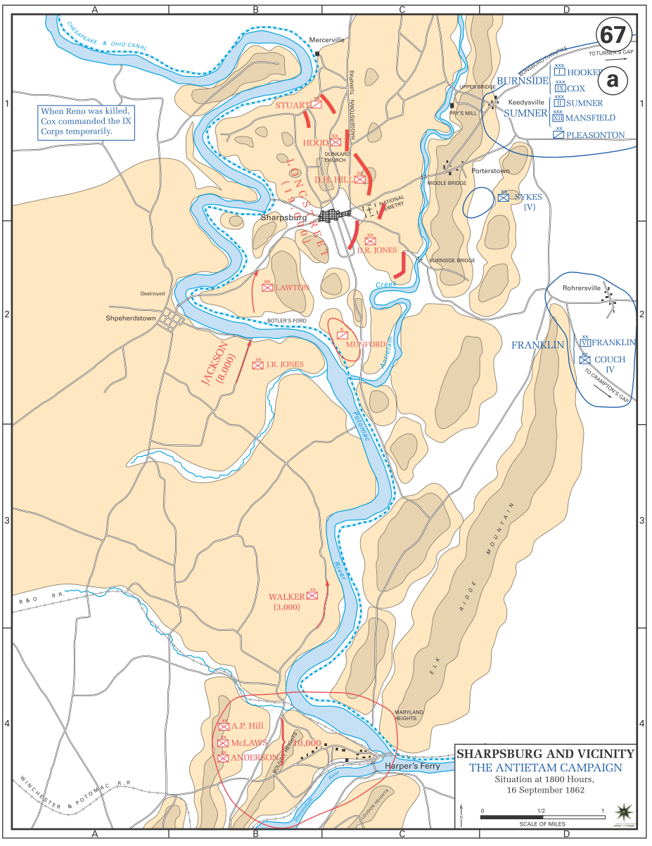
WPMA02 ANTIETAM 16 09
May 30, 2016 · Library of Congress

South Mountain showing the positions of the forces of the United States and the enemy during the battle fought by the Army of the Potomac under the command of Major General G. B. McClellan, Sept. 14th
1872 · Library of Congress

Part of the map of the Battlefield of South Mountains sic, Sept. 14th, 1862. Shewing the Positions of the Forces under the Command of Maj. Genl. A. E. Burnside. Surveyed and Compiled by Arthur de Witzleben and Theodor sic von Kamecke.
September 14, 1862 · U.S. National Archives

(South Mountain showing the positions of the forces of the United States and the enemy during the battle fought by the Army of the Potomac under the command of Major General G. B. McClellan, Sept.
1872 · Library of Congress