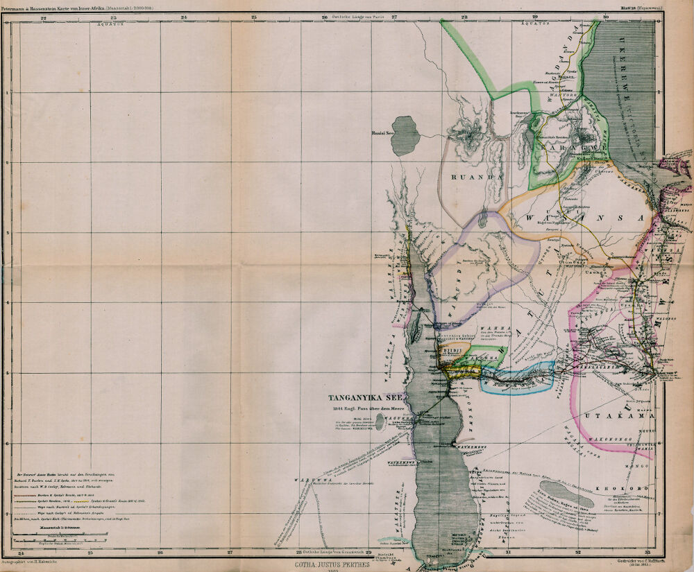

Unyamwesi; Karte von Inner-Afrika
1:2,000,000; Relief shown by hachures. Explorer's routes indicated in color.
- Date
- 1863
- Place
- Africa
- Archive
- Wikimedia Commons
- Type
- map
- Original size
- 1,000 × 825 pixels
Public domain
Reason: a US government work.
This status rests on the map's publication history, as researched by Wikimedia Commons. Check it before commercial use.
Read from: Commons licence category: PD US; no CC BY, CC BY-SA, GFDL or deletion tag on the file page.
Credit line
"Unyamwesi; Karte von Inner-Afrika" (1863). Wikimedia Commons. Public domain. https://commons.wikimedia.org/wiki/File:Unyamwesi;_Karte_von_Inner-Afrika_-_DPLA_-_39a6e4878725d7c7e004779a4365ef71.jpgNeed maps for a whole project? Add Find Any Map to Claude and ask for this one by its id: 236584.
More like this

Karte von Inner-Afrika, Blatt 10 - Unyamwesi
1863 · Wikimedia Commons

Gondókoró; Karte von Inner-Afrika
1863 · Wikimedia Commons

Dar-Fur und Kordofán.; Karte von Inner-Afrika.
1863 · Wikimedia Commons

Map to Illustrate the Explorations in Eastern Africa
1866 · Wikimedia Commons

Central Africa
1883 · Wikimedia Commons

Standpunkt der Erforschung von Central-und Süd-Afrika bis Septembre 1876
1876 · Wikimedia Commons

Carte des lacs de l'Afrique Centrale.
1876 · Wikimedia Commons

Bersichtsskizze der Entdeckungen von S.W. Baker in Central-Afrika
1865 · Wikimedia Commons