
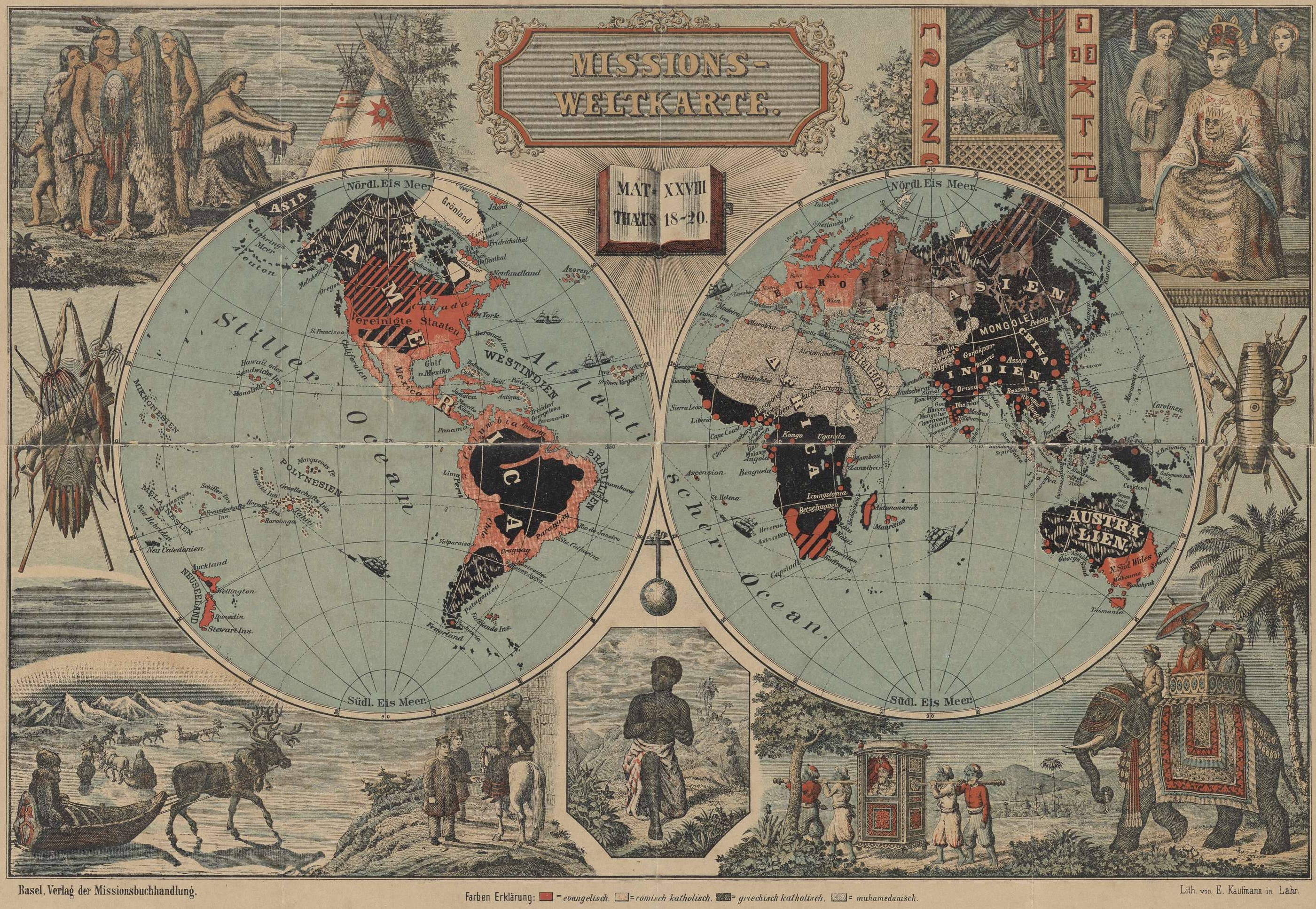
Universiteitsbibliotheek VU - Missions-Weltkarte ca 1891
31 x 46 cm Scale ca. 1:80.000.000 Publisher: Basel: Verlag der Missionsbuchhandlung
- Date
- 1891
- Mapmaker / publisher
- E. Kaufmann, lith
- Scale
- 1:80.000.000
- Archive
- Wikimedia Commons
- Type
- map
- Sheets
- 2
- Original size
- 2,800 × 1,933 pixels
Public domain
Reason: published outside the US before 1996 and already public domain in its home country then.
This status rests on the map's publication history, as researched by Wikimedia Commons. Check it before commercial use.
Read from: Commons licence category: PD-1996; no CC BY, CC BY-SA, GFDL or deletion tag on the file page.
Credit line
"Universiteitsbibliotheek VU - Missions-Weltkarte ca 1891" (1891). E. Kaufmann, lith, via Wikimedia Commons. Public domain. https://commons.wikimedia.org/wiki/File:Universiteitsbibliotheek_VU_-_Missions-Weltkarte_ca_1891_(cropped).jpgNeed maps for a whole project? Add Find Any Map to Claude and ask for this one by its id: 144492.
All 2 sheets
Each sheet links to its file at the archive; the image link is the full-size scan.



More like this

MAP026 L
1860 · Wikimedia Commons

Carte des Missions Catholiques en Afrique
1889 · Wikimedia Commons

Stielers Handatlas 1891 04
1891 · Wikimedia Commons

1846 map - The Protestant missionary map of the world
1846 · Wikimedia Commons

Bacon's Pictorial View of the World
c. 1874 · Wikimedia Commons

Meyer‘s Zeitungsatlas, Karte 1: Die oestliche und westliche Halbkugel der Erde
1849 · Meyer‘s Zeitungsatlas 001

Abraham Jacobus Wendel - Map of South Africa
1900 · Wikimedia Commons

Monteith Chromolithograph Map of the World in Hemispheres
c. 1885 · Wikimedia Commons