

United States Army 1943 map of the Russell Islands as part of British Solomon Islands Protectorate.
- Date
- 1943
- Mapmaker / publisher
- Army Map Service, United States Army
- Archive
- Wikimedia Commons
- Type
- map
- Original size
- 3,209 × 3,654 pixels
Public domainsafest
Reason: a US government work.
Read from: Commons licence category: PD US Government; no CC BY, CC BY-SA, GFDL or deletion tag on the file page.
Credit line
"United States Army 1943 map of the Russell Islands as part of British Solomon Islands Protectorate." (1943). Army Map Service, United States Army, via Wikimedia Commons. Public domain. https://commons.wikimedia.org/wiki/File:1943RussellIslandsmap.jpgNeed maps for a whole project? Add Find Any Map to Claude and ask for this one by its id: 24920.
More like this

The Solomon Islands - 1943
1943 · Wikimedia Commons

Guppy Island raid Choiseul map
c. 1946 · Wikimedia Commons

The Solomon Islands and Papua New Guinea
1947 · Wikimedia Commons

Map of the Munda airfield area, New Georgia, Solomon Islands, 1943
1943 · Wikimedia Commons

UP THE SLOT: Marines in the Central Solomons
1942 · Wikimedia Commons
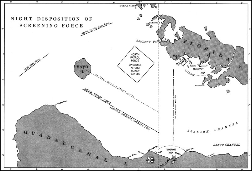
U.S. Navy map from 1943 showing disposition of Allied ships before Battle of Savo Island, 8-9 August 1942.
1943 · Wikimedia Commons

New Georgia Group 1943
1943 · Wikimedia Commons

Composite information map of Guadalcanal, Florida Island and a portion of Malaita Island, December 1942
1942 · U.S. National Archives