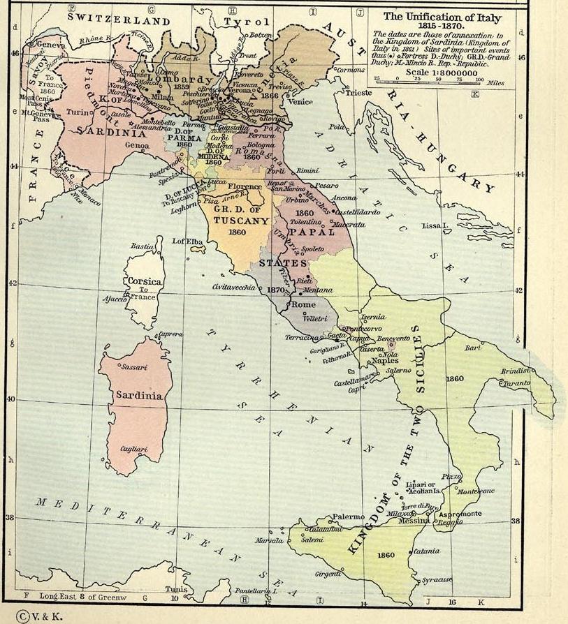

Unification of Italy 1815-1870
Map of unification of Italy, 1815-70
- Date
- 1815
- Mapmaker / publisher
- William R. Shepherd
- Place
- Italian Risorgimento
- Archive
- Wikimedia Commons
- Type
- atlas page
- Original size
- 813 × 894 pixels
Public domain
Reason: its maker died long enough ago that the copyright has expired.
This status rests on the map's publication history, as researched by Wikimedia Commons. Check it before commercial use.
Read from: Commons licence category: PD Old; no CC BY, CC BY-SA, GFDL or deletion tag on the file page.
Credit line
"Unification of Italy 1815-1870" (1815). William R. Shepherd, via Wikimedia Commons. Public domain. https://commons.wikimedia.org/wiki/File:Unification_of_Italy_1815-1870.jpgNeed maps for a whole project? Add Find Any Map to Claude and ask for this one by its id: 20756.
More like this

Völkerkarte von Mittel- und Südosteuropa. Italien 1815 bis zur Gegenwart
1905 · Wikimedia Commons

Historical-map-of-Italy
1890 · Wikimedia Commons

Italian Unity & Eastern Question (Atlas of European history, 1909)
January 19, 2012 · Wikimedia Commons

Nord Italia1815
1905 · Wikimedia Commons

F.W. Putzgers Historischer Schul-Atlas: zur alten, mittleren und neuen Geschichte: in 66 Haupt- und 63 Nebenkarten
Wikimedia Commons

Norditalien und Mittelitalien 1806
1806 · Wikimedia Commons

G. Droysens Historischer Handatlas, 1886
1886 · Page 70, plate 70

Italy at the time of the Lombard kingdom
1880 · Wikimedia Commons