

Übersichtskarte der Bunkerbaustelle Mettenheim Ampfing
- Mapmaker / publisher
- Arbeitskreis Politik und Zeitgeschichte des Franz-Marc-Gymnasiums Markt Schwaben
- Archive
- Wikimedia Commons
- Type
- map
- Original size
- 482 × 664 pixels
Public domain
Reason: public domain: self.
This status rests on the map's publication history, as researched by Wikimedia Commons. Check it before commercial use.
Read from: Commons licence category: PD-self; no CC BY, CC BY-SA, GFDL or deletion tag on the file page.
Credit line
"Übersichtskarte der Bunkerbaustelle Mettenheim Ampfing". Arbeitskreis Politik und Zeitgeschichte des Franz-Marc-Gymnasiums Markt Schwaben, via Wikimedia Commons. Public domain. https://commons.wikimedia.org/wiki/File:%C3%9Cbersichtskarte_der_Bunkerbaustelle_Mettenheim_Ampfing.JPGNeed maps for a whole project? Add Find Any Map to Claude and ask for this one by its id: 23540.
More like this

Map of German Concentration Maps
June 19, 1944 · U.S. National Archives

Mimeographed Map of Busching Defensive Position OVERLAY
1941–1947 · U.S. National Archives

27. (württ.) Inf.Div. 11.4.1917
1917 · Wikimedia Commons
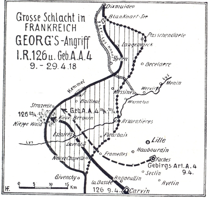
Operation Georg 1918
1918 · Wikimedia Commons

Mai-Angriff 1918
1918 · Wikimedia Commons

Map Soviet 1941 Winter counteroffensive (detail)
1941 · Wikimedia Commons

Operation Undertone Map 1945
1945 · Wikimedia Commons

Tour map 2
1945–2014 · Wikimedia Commons