

U-Bootskrieg - Die Sperrgebiete der europäischen Meere (Verkehrsübersicht)
- Date
- January 31, 1917
- Mapmaker / publisher
- Bearbeitet von C. Erdmann, Lith. v. Irmgedruth
- Archive
- Wikimedia Commons
- Type
- map
- Original size
- 6,759 × 5,366 pixels
Public domain
Reason: a US government work.
This status rests on the map's publication history, as researched by Wikimedia Commons. Check it before commercial use.
Read from: Commons licence category: PD US; no CC BY, CC BY-SA, GFDL or deletion tag on the file page.
Credit line
"U-Bootskrieg - Die Sperrgebiete der europäischen Meere (Verkehrsübersicht)" (January 31, 1917). Bearbeitet von C. Erdmann, Lith. v. Irmgedruth, via Wikimedia Commons. Public domain. https://commons.wikimedia.org/wiki/File:U-Bootskrieg_-_Die_Sperrgebiete_der_europ%C3%A4ischen_Meere_(Verkehrs%C3%BCbersicht).pngNeed maps for a whole project? Add Find Any Map to Claude and ask for this one by its id: 21811.
More like this

U-Bootskrieg - Die Sperrgebiete der europäischen Meere
1917 · Wikimedia Commons

36-U-Boot-Kriegskarte von Europa
1916 · Wikimedia Commons

Sperrgebiete um Europa und Afrika
1925 · Library of Congress

Die Schiffsversenkungen unserer U-Boote - nach Lage und Zahl dargestellt auf Grund amtlichen Materials mit Seeschlachten, Sperrgebieten, Landfronten, Land-Gewinn und -Verlust
1918 · Library of Congress
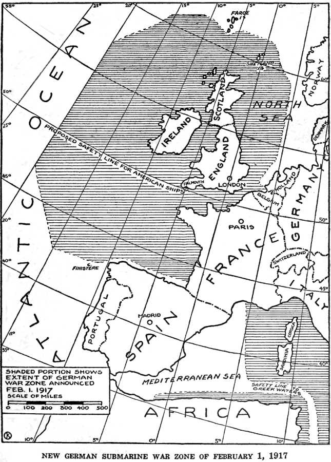
German Submarine War Zone Announced 1 February 1917
1920 · Wikimedia Commons

1916 map - Flemmings U-Boot-Kriegskarte von Europa
1916 · Wikimedia Commons

U-Bootskrieg - Die Sperrgebiete der europäischen Meere (North Sea crop)
1917 · Wikimedia Commons

A German illustration of "freedom of the seas" in war time - (Western Europe and western Mediterranean Sea).
1915 · Library of Congress