

Tropical America photoscopic mapguide & roadlog - South Miami, Ingraham Highway, Redland district, South Dade County, Florida Keys, Overseas Highway, Key West
Relief shown pictorially. "This is a non-scale map designed for directional use only." Includes text, indexed directory to points of interest, roadlog, and advertisements.
- Date
- 1941
- Mapmaker / publisher
- Joseph W. John & Associates; Sniffen, Lon M.; Morgan, W. D
- Place
- Dade County, Florida
- Archive
- Library of Congress (via Wikimedia Commons)
- Type
- map
- Original size
- 8,553 × 11,044 pixels
Public domain
Reason: a US government work.
This status rests on the map's publication history, as researched by Wikimedia Commons. Check it before commercial use.
Read from: Commons licence category: PD US Government; no CC BY, CC BY-SA, GFDL or deletion tag on the file page; Commons tags it as a US government work, but its record names no government maker.
Credit line
"Tropical America photoscopic mapguide & roadlog - South Miami, Ingraham Highway, Redland district, South Dade County, Florida Keys, Overseas Highway, Key West" (1941). Joseph W. John & Associates; Sniffen, Lon M.; Morgan, W. D. Library of Congress, Geography and Map Division, via Wikimedia Commons. Public domain. https://commons.wikimedia.org/wiki/File:Tropical_America_photoscopic_mapguide_%26_roadlog_-_South_Miami,_Ingraham_Highway,_Redland_district,_South_Dade_County,_Florida_Keys,_Overseas_Highway,_Key_West_LOC_2013593064.jpgNeed maps for a whole project? Add Find Any Map to Claude and ask for this one by its id: 120498.
More like this

Correct map of Florida - season of 1894-5 - showing the Tropical Trunk Line - comprising the Jacksonville, Tampa & Key West R'y, the Florida Southern Railroad Co., Indian River Steamboat Company
1894 · Library of Congress

Map of the city of Miami and environs - showing the greater Miami development and the estimated expansion for 1935
1925 · Library of Congress
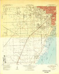
South Miami, Florida: USGS topographic map, 1:24,000 (1950–1994)
1950–1994 · 6 editions

Map of the peninsula of Florida and adjacent islands - East Coast Line, the St. Augustine routes and connections.
1893 · Library of Congress

National City guide to the Americas pictorial map
1940 · Wikimedia Commons
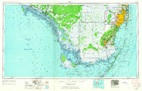
Miami, Florida: USGS topographic map, 1:250,000 (1956–1988)
1956–1988 · 7 editions

Greater Los Angeles - the wonder city of America
1932 · Library of Congress

Caribbean America. 4-61.
1961 · Library of Congress