

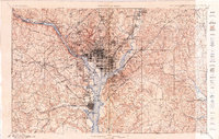
Topographical map of Washington, D.C. - 1899-1900
9105 U.S. Copyright Office Shows major buildings, block numbers in central city, and land tracts with owners' names and acreages beyong old city limits. Relief shown by contours. Oriented with north toward the upper left. Includes note and inset. DCP
- Date
- 1900
- Mapmaker / publisher
- Thorn, C. W.; Baily, Thomas C. J.; Globe Map & Atlas Co
- Place
- Washington, D.C.
- Archive
- Library of Congress (via Wikimedia Commons)
- Type
- map
- Original size
- 16,487 × 12,085 pixels
Public domainsafest
Reason: its maker died more than 100 years ago.
Read from: Commons licence category: PD-old-100-expired; no CC BY, CC BY-SA, GFDL or deletion tag on the file page.
Credit line
"Topographical map of Washington, D.C. - 1899-1900" (1900). Thorn, C. W.; Baily, Thomas C. J.; Globe Map & Atlas Co. Library of Congress, Geography and Map Division, via Wikimedia Commons. Public domain. https://commons.wikimedia.org/wiki/File:Topographical_map_of_Washington,_D.C._-_1899-1900_LOC_87694383.jpgNeed maps for a whole project? Add Find Any Map to Claude and ask for this one by its id: 120327.
More like this

Topographical map of the District of Columbia and a portion of Virginia
1889 · Library of Congress

Map of the District of Columbia - 1901
1902 · Library of Congress

Map of the District of Columbia - 1901
1901 · Library of Congress

Map of the District of Columbia and adjacent portions of Maryland and Virginia
1891 · Library of Congress

Part of the District of Columbia - June 1896
1896 · Library of Congress

Topographical map of the District of Columbia
1880 · Library of Congress

Topographical map of the District of Columbia and a portion of Virginia
1884 · Library of Congress
Washington, Maryland: USGS topographic map, 1:62,500 (1900)
1900 · 2 editions