

Topographical map, 1st Brigade, defenses north of Potomac, Washington, D.C.
"1st September 1863." Relief shown by contours. Some buildings, lot lines, householders' names, forts, and vegetation. Covers environs of Forts De Russy, Stevens, Slocum, Totten, Slemmer, Bunker Hill, Saratoga, Thayer, Lincoln, and Batteries Sill and Jameson. India and red inks. Lacking edge and internal sections, assembled to 1 sheet, sectioned to 4 sheets, and mounted on cloth backing. Includes notes and 2 scale graphs. "189. L. sheet 1." ) 680 Vault DCP
- Date
- 1863
- Mapmaker / publisher
- Hodasevich, R. A
- Place
- Washington, D.C.
- Archive
- Library of Congress (via Wikimedia Commons)
- Type
- map
- Original size
- 23,675 × 11,597 pixels
Public domainsafest
Reason: its maker died more than 100 years ago.
Read from: Commons licence category: PD-old-100-expired; no CC BY, CC BY-SA, GFDL or deletion tag on the file page.
Credit line
"Topographical map, 1st Brigade, defenses north of Potomac, Washington, D.C." (1863). Hodasevich, R. A. Library of Congress, Geography and Map Division, via Wikimedia Commons. Public domain. https://commons.wikimedia.org/wiki/File:Topographical_map,_1st_Brigade,_defenses_north_of_Potomac,_Washington,_D.C._LOC_88690656.jpgNeed maps for a whole project? Add Find Any Map to Claude and ask for this one by its id: 315.
More like this

Topographical map, 1st Brigade, defenses north of Potomac, Washington, D.C. (West)
1863 · Library of Congress
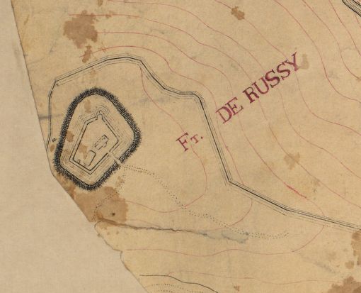
Fort DeRussy — Topographical map, 1st Brigade, defenses north of Potomac, Washington, D.C. (West)
1863 · Library of Congress

Topographical map, 1st Brigade, defenses north of Potomac, Washington, D.C. (EAST)
September 1, 1863 · Library of Congress

Fort Lincoln — Topographical map, 1st Brigade, defenses north of Potomac, Washington, D.C. (EAST)
September 1, 1863 · Library of Congress

Fort Bunker Hill — Topographical map, 1st Brigade, defenses north of Potomac, Washington, D.C. (EAST)
September 1, 1863 · Library of Congress

Fort Lincoln and Battery Jameson — Topographical map, 1st Brigade, defenses north of Potomac, Washington, D.C. (EAST)
September 1, 1863 · Library of Congress

Fort Saratoga — Topographical map, 1st Brigade, defenses north of Potomac, Washington, D.C. (EAST)
September 1, 1863 · Library of Congress

Map of the environs of Washington - compiled from Boschkes' map of the District of Columbia and from surveys of the U.S. Coast Survey showing the line of the defences of Washington as constructed
1865 · Library of Congress