

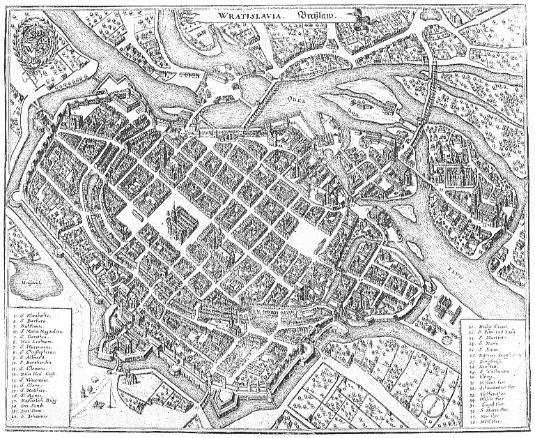
Topographia Bohemiae, Moraviae Et Silesiae.
Wrocław
- Date
- 1650
- Mapmaker / publisher
- Martin Zeiller
- Place
- Wrocław
- Archive
- Wikimedia Commons
- Type
- map
- Original size
- 2,219 × 1,777 pixels
Public domainsafest
Reason: its maker died more than 100 years ago.
Read from: Commons licence category: PD-old-100-expired; no CC BY, CC BY-SA, GFDL or deletion tag on the file page.
Credit line
"Topographia Bohemiae, Moraviae Et Silesiae." (1650). Martin Zeiller, via Wikimedia Commons. Public domain. https://commons.wikimedia.org/wiki/File:Statt_Bre%C3%9Flau_im_Grund_(Merian).jpgNeed maps for a whole project? Add Find Any Map to Claude and ask for this one by its id: 254757.
More like this

Wratislavia
Wikimedia Commons

Bohemiae Moraviae et Silesiae (Merian) 266
Wikimedia Commons

Bohemiae Moraviae et Silesiae (Merian) 196
Wikimedia Commons

Bohemiae Moraviae et Silesiae (Merian) 004
Wikimedia Commons

Wratislavia - Bresslaw. 1641
1641 · Wikimedia Commons

Breslaw
1650–1750 · Wikimedia Commons
Wratislavia - Breßlaw
c. 1660 · Wikimedia Commons

Civitates orbis terrarum. Urbium praecipuarum totius mundi. Liber quartus (page 88)
1594 · Wikimedia Commons