

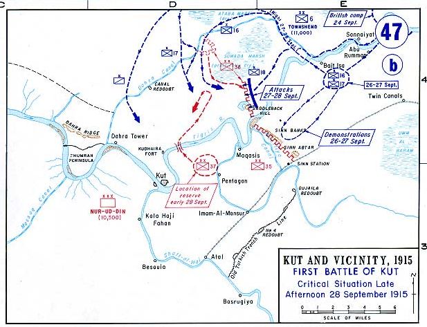
This map shows the 1st British capture of Kut, in 1915, under General Townshend. See Siege of Kut
- Date
- 1915
- Mapmaker / publisher
- This map was created by the Department of Military Art and Engineering, at the U.S. Military Academy (West Point)
- Archive
- Wikimedia Commons
- Type
- map
- Original size
- 594 × 453 pixels
Public domainsafest
Reason: a US government work.
Read from: Commons licence category: PD US Government; no CC BY, CC BY-SA, GFDL or deletion tag on the file page.
Credit line
"This map shows the 1st British capture of Kut, in 1915, under General Townshend. See Siege of Kut" (1915). This map was created by the Department of Military Art and Engineering, at the U.S. Military Academy (West Point), via Wikimedia Commons. Public domain. https://commons.wikimedia.org/wiki/File:Meso-WW1-4.jpgNeed maps for a whole project? Add Find Any Map to Claude and ask for this one by its id: 23026.
More like this

This map shows the 2nd conquest of Kut by the British under General Maude in 1917. See Second Battle of Kut.
1917 · Wikimedia Commons
Kut1915
Wikimedia Commons

This map shows Townshend's attack towards Baghdad, 1915.
1915 · Wikimedia Commons
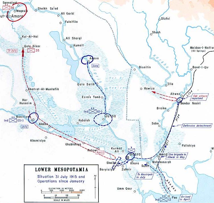
This map shows the British advance into Southern Mesopotamia, 1915.
1915 · Wikimedia Commons

Battle of Ctesiphon (1915).
1915 · Wikimedia Commons

This map shows the initial British attack and capture of Basra, 1914. See Battle of Basra (1914).
1914 · Wikimedia Commons

Kut-el-Amara-map
Wikimedia Commons

Hand-drawn map of the Siege of Kut-El-Amara in World War I in Iraq
c. 1917 · Wikimedia Commons