

The realm of Greek speaking King Zoscales in Axum who ruled in what is now Ethopia in the first century of the Common Era is shown, while to the south the "Arab realm of the tyrant Mapharites" is located
ARRIAN'S WORLD as depicted by ORTELIUS, 1624
- Date
- 1624
- Mapmaker / publisher
- Abraham Ortelius
- Archive
- Wikimedia Commons
- Type
- map
- Original size
- 609 × 775 pixels
Public domain
Reason: its maker died long enough ago that the copyright has expired.
This status rests on the map's publication history, as researched by Wikimedia Commons. Check it before commercial use.
Read from: Commons licence category: PD Old; no CC BY, CC BY-SA, GFDL or deletion tag on the file page.
Credit line
"The realm of Greek speaking King Zoscales in Axum who ruled in what is now Ethopia in the first century of the Common Era is shown, while to the south the "Arab realm of the tyrant Mapharites" is located" (1624). Abraham Ortelius, via Wikimedia Commons. Public domain. https://commons.wikimedia.org/wiki/File:The_realm_of_Greek_speaking_King_Zoscales_in_Axum_who_ruled_in_what_is_now_Ethopia_in_the_first_century_of_the_Common_Era_is_shown,_while_to_the_south_the_%22Arab_realm_of_the_tyrant_Mapharites%22_is_located.jpgNeed maps for a whole project? Add Find Any Map to Claude and ask for this one by its id: 20885.
More like this

Erythraei Sive Rubri Maris Periplus Olim ab Arriano Descriptus
1624 · Wikimedia Commons

Arabia and the Red Sea
1624 · Wikimedia Commons

Ortelius notes that the region was earlier described by Flavius Arrianus (Arrian) and expanded upon by Ortelius in this presentation
1624 · Wikimedia Commons

Turning to the principal map based on Arrian's accounts of the expeditions of Alexander the Great we find Ceylon (Sri Lanka) shown as Taprobana, and slithering sea serpents near the mouth of the Indus
1624 · Wikimedia Commons

The Punic text from the Periplus of Hanno describing Hanno of Carthage's journey beyond the Pillars of Hercules (Strait of Gibraltar) and the establishment of the cities shown on this inset map can be found here
1624 · Wikimedia Commons

Erythraei sive Rubri Maris Periplus
Wikimedia Commons

Presbiteri Johannis, sive, Abissinorum imperii descriptio
1573 · Wikimedia Commons
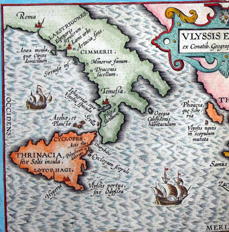
Aeaea, the island of Circe, located south of Rome with the Islands of the Sirens closeby
1624 · Wikimedia Commons