

The POL pipeline systems
- Date
- 1959
- Mapmaker / publisher
- D. Holmes Jr
- Archive
- Wikimedia Commons
- Type
- map
- Original size
- 1,693 × 2,166 pixels
Public domainsafest
Reason: a US government work (US Army).
Read from: Commons licence category: PD US Army; no CC BY, CC BY-SA, GFDL or deletion tag on the file page.
Credit line
"The POL pipeline systems" (1959). D. Holmes Jr, via Wikimedia Commons. Public domain. https://commons.wikimedia.org/wiki/File:The_POL_pipeline_systems.pngNeed maps for a whole project? Add Find Any Map to Claude and ask for this one by its id: 24689.
More like this
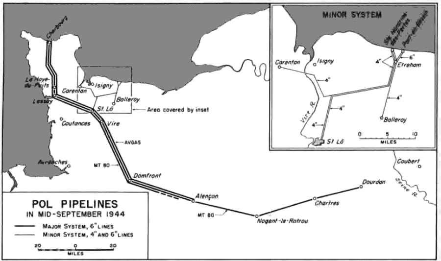
POL pipelines in mid-September 1944
1953 · Wikimedia Commons

Map of allied breakout and advance to the German border
1954 · Wikimedia Commons

Communications Zone boundaries April 1945
1959 · Wikimedia Commons

Railways in use in mid-September 1944
1953 · Wikimedia Commons

Map of allied breakout and advance to the Seine
1954 · Wikimedia Commons

Railways in use by US forces east of Paris
1959 · Wikimedia Commons

Truck routes in use by the US Army, 25 March - 8 May 1945
1959 · Wikimedia Commons

Map made by the Command of General Patch
1941–1947 · Page 1