

The notation on New Guinea states that "Andreas Corsalus names this land Piccinaculi, and whether it is an island or part of a southern continent is unknown
SOUTH AND SOUTHEAST ASIA, 1603 "Indiae Orientalis, Insularumque Adiacientium Typus," from the Theatrum Orbis Terrarum of Abraham Ortelius, 1603 Latin edition The seller, *regiomontanus*, provides useful commentary that is reproduced here with only slight editing: "This scarce and important original map of East Asia (49.5 x 35 cm copperplate engraving, 54 x 40.5 cm sheet size, later hand colour, Antwerp, circa 1603) comes from the 1603 Latin edition of the Theatrum Orbis Terrarum of Abraham Ortelius (1527-1598), the first true atlas in the modern sense. It was one of the most famous and influential maps published in the Theatrum. Ortelius drew upon earlier maps by Mercator, as well as the accounts of Marco Polo and Antonio Pigafetti, a survivor of Magellan's circumnavigation. The map provides a fascinating snapshot of a part of the world just starting to be understood in the great age of exploration, and the flamboyant decorative elements understandably make it one of the most celebrated and sought-after of all Ortelius maps. The handsome title cartouche announces the region described as the "East Indies and surrounding islands." Many of the ornate cartouches used by Ortelius's engr
- Date
- 1500–1650
- Mapmaker / publisher
- Abraham Ortelius
- Place
- New Guinea
- Archive
- Wikimedia Commons
- Type
- map
- Original size
- 600 × 534 pixels
Public domain
Reason: its maker died long enough ago that the copyright has expired.
This status rests on the map's publication history, as researched by Wikimedia Commons. Check it before commercial use.
Read from: Commons licence category: PD Old; no CC BY, CC BY-SA, GFDL or deletion tag on the file page.
Credit line
"The notation on New Guinea states that "Andreas Corsalus names this land Piccinaculi, and whether it is an island or part of a southern continent is unknown" (1500–1650). Abraham Ortelius, via Wikimedia Commons. Public domain. https://commons.wikimedia.org/wiki/File:The_notation_on_New_Guinea_states_that_%22Andreas_Corsalus_names_this_land_Piccinaculi,_and_whether_it_is_an_island_or_part_of_a_southern_continent_is_unknown%22.jpgNeed maps for a whole project? Add Find Any Map to Claude and ask for this one by its id: 243053.
More like this
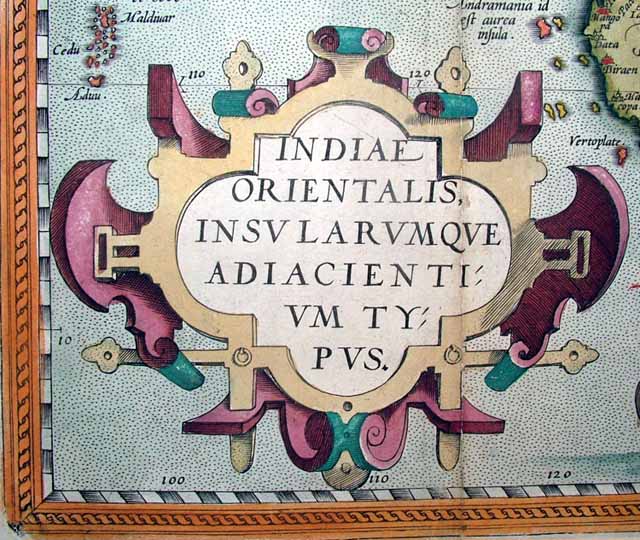
The handsome title cartouche announces the region described as the "East Indies and surrounding islands.
1500–1650 · Wikimedia Commons

Singapore is shown as "Cincapura", Siam as "Sian" with "Camboia" to the east
1500–1650 · Wikimedia Commons

India is mapped with dozens of place-names
1500–1650 · Wikimedia Commons

Indiae Orientalis, Insularumque Adiacientium Typus," from the Theatrum Orbis Terrarum of Abraham Ortelius, 1603 Latin edition
1500–1650 · Wikimedia Commons

Luzon is missing in the Philippines and all islands are somewhat distorted -- to get a sense of the map's detail consider that the distance from "Manado" on Borneo to "Manadu" on Celebes measures just 6 cm actual size
1500–1650 · Wikimedia Commons

China is shown with no Korean peninsula
1500–1650 · Wikimedia Commons

The banner advertises the fact that the Moluccan Islands "export fragrant spices all over the world
1500–1650 · Wikimedia Commons

Ortelius follows Mercator in placing the mythical Lake Chyamai northeast of India and showing it as the source of numerous rivers
1500–1650 · Wikimedia Commons