

The German U-Boat Raid Off the United States Coast
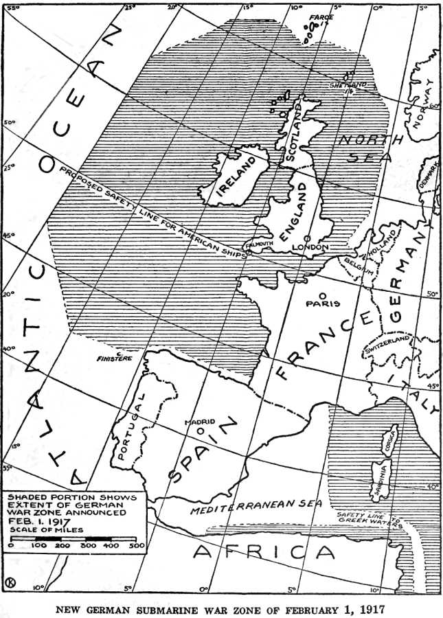
The sinking of two Norwegian steamships by a German submarine on June 10 about 100 miles east of Cape Charles raised the number of vessels attacked since May 25 to over a score. Most of the ships lost belonged to the United States, the second heaviest sufferer being Norway, with four vessels. The above map shows the range within which the German U-boat, or U-boats, (the number of the raiders is still in doubt,) operated during the six-teen days since the attack on shipping in American home waters began. It will be seen that the submarine campaign has been carried almost to the threshold of America's greatest shipping centre, and that the ships have been sunk on the busiest traffic routes along the coast as far south as Cape Charles. The American naval authorities were first aware of the German submarine's presence on June 2, and although naval and aerial patrols have been busy ever since, the U-boat has been able to elude detection and continue its campaign of destruction.
- Date
- c. 1917
- Place
- the United States
- Archive
- Wikimedia Commons
- Type
- map
- Original size
- 6,141 × 8,981 pixels
Public domainsafest
Reason: its maker died more than 70 years ago.
Read from: Commons licence category: PD-old-70-expired; no CC BY, CC BY-SA, GFDL or deletion tag on the file page.
Credit line
"The German U-Boat Raid Off the United States Coast" (c. 1917). Wikimedia Commons. Public domain. https://commons.wikimedia.org/wiki/File:The_German_U-Boat_Raid_Off_the_United_States_Coast.jpgNeed maps for a whole project? Add Find Any Map to Claude and ask for this one by its id: 21847.
More like this

Collier's 1921 World War - German submarine blockade
1921 · Wikimedia Commons
German Submarine War Zone Announced 1 February 1917
1920 · Wikimedia Commons

German Submarine Zone February 1915 SGW Vol V
1919 · Wikimedia Commons

U-Bootskrieg - Die Sperrgebiete der europäischen Meere (North Sea crop)
1917 · Wikimedia Commons

A German illustration of "freedom of the seas" in war time - (Western Europe and western Mediterranean Sea).
1915 · Library of Congress

Here are the Kaiser's war plans - National Security League's warning to thoughtful Americans - how Germany wanted the world to look - a graphic explanation of why there is a war.
1917 · Library of Congress

Sperrgebiete um Europa und Afrika
1925 · Library of Congress

US 14 inch 50 caliber Naval guns operations map 1918
c. 1922 · Wikimedia Commons