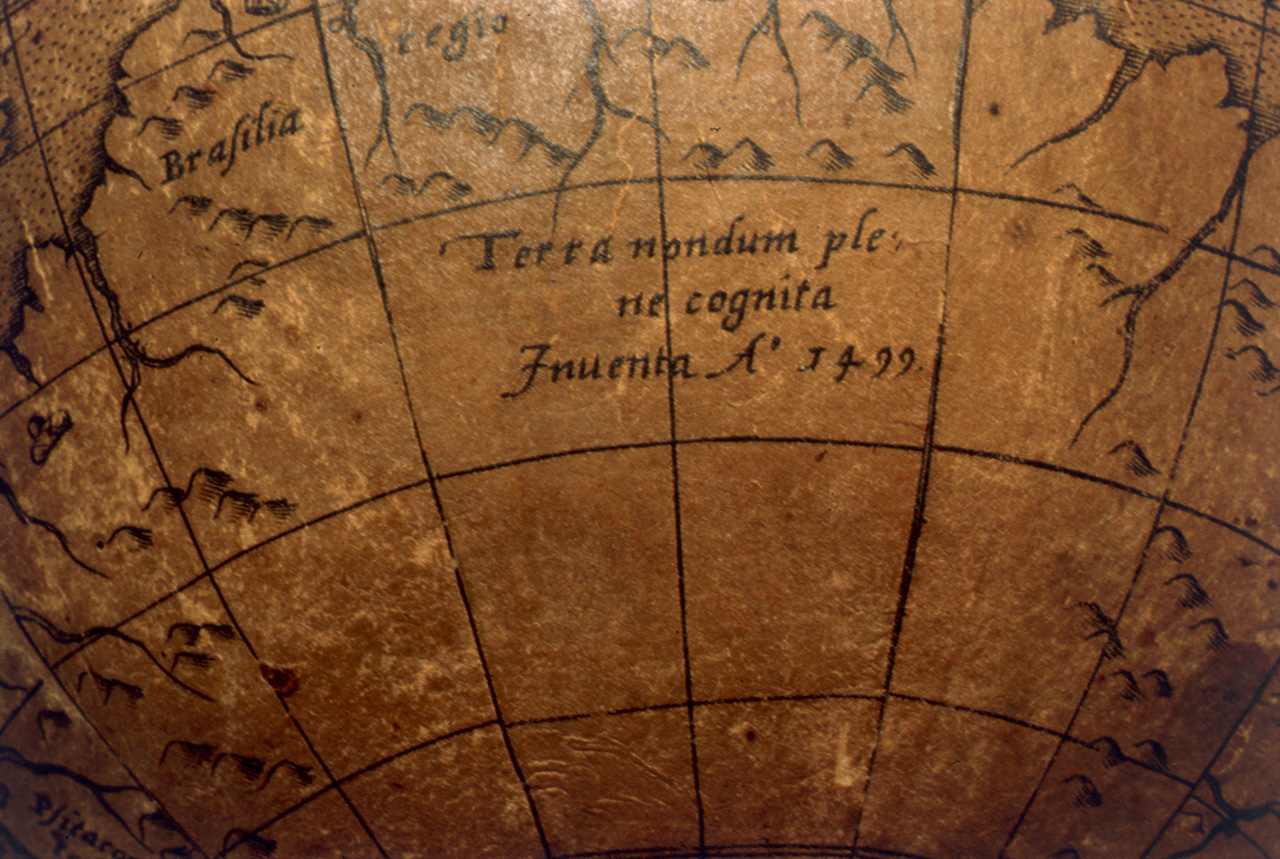

Terrestrial table globe RMG D7262 c
Terrestrial table globe Terrestrial table globe. It forms a pair with the celestial globe, Osterschaden GLB0120. Geographical details on the sphere include kingdoms indicated by little crowns. The world is divided into two parts. There are three labels in North America and two in South America. In Africa there is a figure labelled 'Papa loannes', symbolised by headgear, which might represent a papal tiara. In Asia there is a portrait with a label, and Japan is labelled 'Zipangri'. The Indonesian archipelago is labelled and accompanied by a note with the date 1520. There is a label in the southern continent and a note with the date 1499. There are decorations including ships and sea monsters in the oceans, and an elephant in Africa. A total of six oceans are named. In the later edition of the Oterschaden gores, reissued by Paulus Furst in Nuremberg, the note 'Terra nondum plene cognita Inuenta A° 1499' is absent. For full details about the cartography and construction of this globe please refer to the related publication. note in hypothetical southern continent
- Date
- c. 1600
- Mapmaker / publisher
- Joannes Oterschaden
- Place
- South America
- Archive
- Wikimedia Commons
- Type
- chart
- Original size
- 1,280 × 859 pixels
Public domainsafest
Reason: its maker died more than 100 years ago.
Read from: Commons licence category: PD-old-100-expired; no CC BY, CC BY-SA, GFDL or deletion tag on the file page.
Credit line
"Terrestrial table globe RMG D7262 c" (c. 1600). Joannes Oterschaden, via Wikimedia Commons. Public domain. https://commons.wikimedia.org/wiki/File:Terrestrial_table_globe_RMG_D7262_c.jpgNeed maps for a whole project? Add Find Any Map to Claude and ask for this one by its id: 305641.
More like this

Terrestrial table globe RMG D8043 2
c. 1550 · Wikimedia Commons

Terrestrial table globe RMG D7243 1
1602 · Wikimedia Commons

Terrestrial table globe RMG D7845 4
1589 · Wikimedia Commons

Terrestrial table globe RMG D7256 3
c. 1621 · Wikimedia Commons

Terrestrial table globe RMG D7256 1
c. 1621 · Wikimedia Commons

Terrestrial table globe RMG D7240 1
1602–1621 · Wikimedia Commons

Celestial table globe RMG F2135
1602 · Wikimedia Commons

Celestial table globe RMG F1055
1700 · Wikimedia Commons