

Submarine action Malacca Strai 1944
A map of Malacca Strait and surroundings featuring the loacation of German Navy submarine UIT-23's wreck in the Action of 14 February 1944.
- Date
- 1944
- Mapmaker / publisher
- $1LENCE D00600D (talk)
- Archive
- Wikimedia Commons
- Type
- map
- Original size
- 916 × 599 pixels
Public domain
Reason: public domain: user.
This status rests on the map's publication history, as researched by Wikimedia Commons. Check it before commercial use.
Read from: Commons licence category: PD-user; no CC BY, CC BY-SA, GFDL or deletion tag on the file page.
Credit line
"Submarine action Malacca Strai 1944" (1944). $1LENCE D00600D (talk), via Wikimedia Commons. Public domain. https://commons.wikimedia.org/wiki/File:Submarine_action_Malacca_Strai_1944.pngNeed maps for a whole project? Add Find Any Map to Claude and ask for this one by its id: 23301.
More like this

Mappa Forza Z
1941 · Wikimedia Commons

Map of United States Submarines Forces Southwest Pacific operating area World War 2 circa 1943
1943 · Wikimedia Commons

Map of the front against Japan as of 15 May 1944: This map is taken from the source "Atlas of the World Battle Fronts in Semimonthly Phases to August 15th 1945: Supplement to The Biennial report of Th
1944 · Wikimedia Commons

Map of the front against Japan as of 15 Jan 1944: This map is taken from the source "Supplement to The Biennial report of the Chief of Staff of the United States Army July 1, 1943 to June 30 1945". (S
1943 · Wikimedia Commons

Japanese Attacks Along the Malay Barrier
1941 · Wikimedia Commons
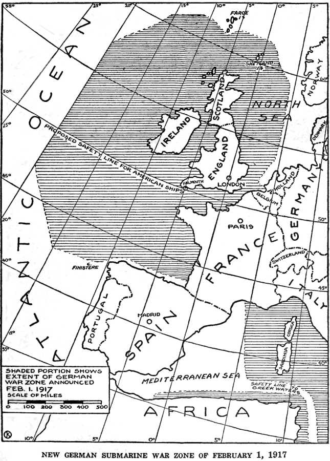
German Submarine War Zone Announced 1 February 1917
1920 · Wikimedia Commons

Map of Sumatra and the Malacca Straits
1685 · Wikimedia Commons

Solomon Islands Campaign battles map 1944
1944 · Wikimedia Commons