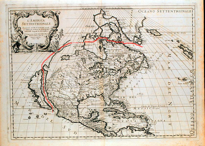

Straße von Anian
Map of North America by Guillaume Sanson, Rome, 1687. Estimated position of Strait of Anián is marked.
- Date
- 1687
- Mapmaker / publisher
- Guillaume Sanson
- Place
- North America
- Archive
- Wikimedia Commons
- Type
- map
- Original size
- 700 × 499 pixels
Public domain
Reason: its maker died more than 70 years ago, and a faithful scan of a flat work adds no new copyright.
This status rests on the map's publication history, as researched by Wikimedia Commons. Check it before commercial use.
Read from: Commons licence category: PD-Art (PD-old-70); no CC BY, CC BY-SA, GFDL or deletion tag on the file page; permission field: PD-art.
Credit line
"Straße von Anian" (1687). Guillaume Sanson, via Wikimedia Commons. Public domain. https://commons.wikimedia.org/wiki/File:Stra%C3%9Fe_von_Anian.pngNeed maps for a whole project? Add Find Any Map to Claude and ask for this one by its id: 296120.
More like this

Strait of Anian from Novissima totius tarrarum orbis tabula by Hugo Allard
1685 · Wikimedia Commons

Map of North America, 1685
1683–1719 · Wikimedia Commons

North America divided into its principall parts where are distinguished the severall states which belong to the English, Spanish, and French - described by Sanson; corrected and amended by NYPL465053
1680–1689 · New York Public Library

Amérique septentrionale
1650 · Library of Congress

Amérique septentrionale divisée en ses principales parties, ou sont distingués les vns des autres les estats suivant qu'ils appartiennent presentemet aux François, Castillans, Anglois, Suedois
1674 · Library of Congress

Map of North and Central America
c. 1705 · Wikimedia Commons

Amérique septentrionale / par N. Sanson d'Abbeville; reveüe. par G. Sanson
1669 · Wikimedia Commons

L'Amerique septentrionale: dressée sur les observations de Mrs. de l'Academie Royale des Sciences & quelques autres, & sur les memoires les plus recens
1700–1708 · 2 sheets