

State of Burma orthographic map
Green: Under government authority Light silver: Remainder of Burma Light green: Occupied and annexed by Thailand
- Date
- July 11, 2010
- Place
- State of Burma
- Archive
- Wikimedia Commons
- Type
- map
- Original size
- 1,000 × 1,000 pixels
Public domain
Reason: public domain: user.
This status rests on the map's publication history, as researched by Wikimedia Commons. Check it before commercial use.
Read from: Commons licence category: PD-user; no CC BY, CC BY-SA, GFDL or deletion tag on the file page.
Credit line
"State of Burma orthographic map" (July 11, 2010). Wikimedia Commons. Public domain. https://commons.wikimedia.org/wiki/File:State_of_Burma_orthographic_map.pngNeed maps for a whole project? Add Find Any Map to Claude and ask for this one by its id: 23398.
More like this

Free India orthographic map
July 11, 2010 · Wikimedia Commons
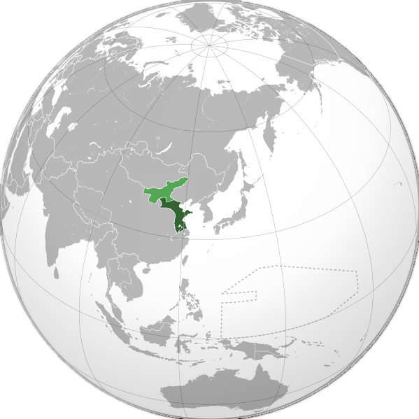
Green: Republic of China-Nanjing in 1939 Elm: Mengjiang (incorporated as region in 1940)
June 3, 2010 · Wikimedia Commons

Green: Karafuto Prefecture within Japan in 1942 Light green: Other constituents of Imperial Japan
June 3, 2010 · Wikimedia Commons

A stunning large format Japanese map of Burma dating to World War II. Covers the entirety of the country with color coding according to district. Offers superb detail regarding both topographical and
1943 · Wikimedia Commons

Burma administrative divisions.
2007 · Library of Congress

Manchu State
December 7, 2010 · Wikimedia Commons

Greater Japanese empire
June 3, 2010 · Wikimedia Commons

Korea in japanese empire
June 3, 2010 · Wikimedia Commons