

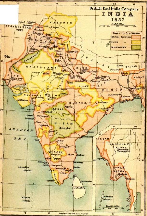
Stanford's map of India, 1857 (cropped to eastern zone)
Map showing Bengal, Bihar, Orissa region in 1857
- Date
- 1857
- Mapmaker / publisher
- Stanford, Edward (1827-1904)
- Place
- India
- Archive
- Wikimedia Commons
- Type
- map
- Original size
- 4,178 × 3,134 pixels
Public domainsafest
Reason: its US copyright has expired (published before 1931).
Read from: Commons licence category: PD US expired; no CC BY, CC BY-SA, GFDL or deletion tag on the file page.
Credit line
"Stanford's map of India, 1857 (cropped to eastern zone)" (1857). Stanford, Edward (1827-1904), via Wikimedia Commons. Public domain. https://commons.wikimedia.org/wiki/File:Stanford%27s_map_of_India,_1857_(cropped_to_eastern_zone).jpgNeed maps for a whole project? Add Find Any Map to Claude and ask for this one by its id: 255463.
More like this

Ca. 1860 map of India and neighbouring countries (Cropped to Eastern Zone)
1860 · Wikimedia Commons

The Sketch Map Showing Provincial and District Divisions to Accompany the Administration Report, 1872–73 (Cropped to Bihar, Chota Nagpur, and Odisha)
1873 · Wikimedia Commons

Northern division
1843 · Wikimedia Commons

A Statistical Account of Bengal — Volume 18 Map
1873 · Wikimedia Commons

A Map of Hindoostan, or the Mogul Empire (Cropped to Eastern Zone)
1788 · Wikimedia Commons

Northern India 1857
1857 · Wikimedia Commons

A Statistical Account of Bengal — Volume 19 Map
1873 · Wikimedia Commons
Map BEIC 1857
1857 · Wikimedia Commons