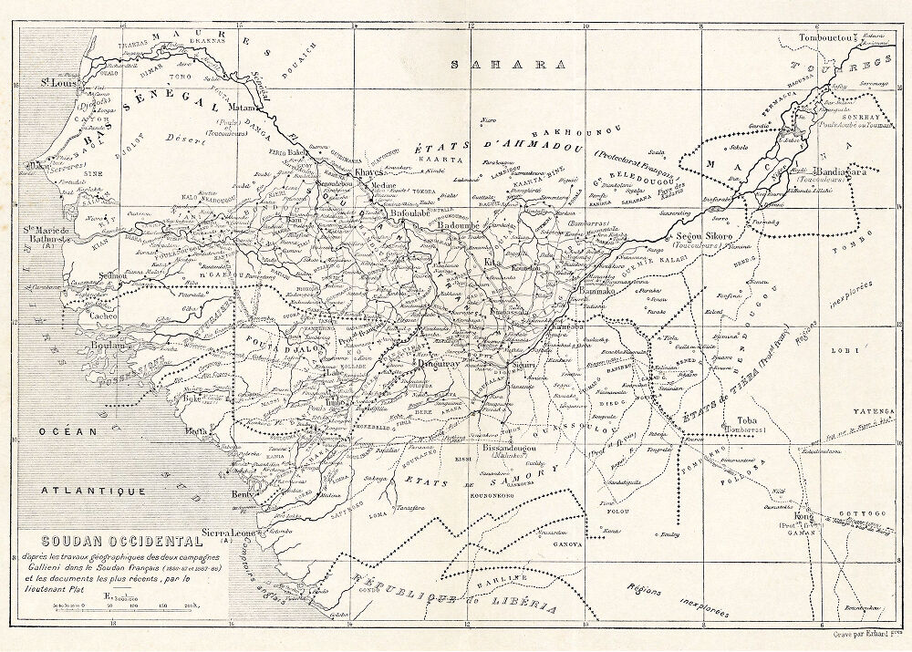

Soudan Occidental d'apres les travaux géographiques des campagnes Gallieni.
1:7,000,000; Relief shown by spot heights. Explorers' routes indicated by dashed lines.
- Date
- 1890
- Place
- Africa
- Archive
- Wikimedia Commons
- Type
- map
- Original size
- 1,000 × 715 pixels
Public domain
Reason: a US government work.
This status rests on the map's publication history, as researched by Wikimedia Commons. Check it before commercial use.
Read from: Commons licence category: PD US; no CC BY, CC BY-SA, GFDL or deletion tag on the file page.
Credit line
"Soudan Occidental d'apres les travaux géographiques des campagnes Gallieni." (1890). Wikimedia Commons. Public domain. https://commons.wikimedia.org/wiki/File:Soudan_Occidental_d%27apres_les_travaux_g%C3%A9ographiques_des_campagnes_Gallieni..._-_DPLA_-_b3b6fe26b0afda60fb623162edfe889b.jpgNeed maps for a whole project? Add Find Any Map to Claude and ask for this one by its id: 237445.
More like this

Soudan Occidentale d'après les travaux géographiques des deux campagnes Gallieni dans le Soudan français (1886-1887) et (1887-1888) et les documents les plus récents (fin-1890) par le Lieut. Plat de lnfie de Marine.
1889 · Wikimedia Commons

Itinéraires levés dans le Soudan Français par ordre du Lt. Colonel-Galieni, 1886-1888.
1889 · Wikimedia Commons

Soudan occidental-1889
1889 · New York Public Library

Soudan Occidental Fouta-Diallon et Bambouc
1884 · Wikimedia Commons

Carte pour l'étude des voies de pénétration au Soudan
1891 · Wikimedia Commons

Campagne 1889-1990. Lieutenant Colonel Archinard Ct Supérieure. Carte Politique du Soudan Français. Echelle 1/1.500.000
1889–1890 · Wikimedia Commons

Carte du Soudan Français
1889 · Wikimedia Commons

Soudan Occidental
1883 · Wikimedia Commons