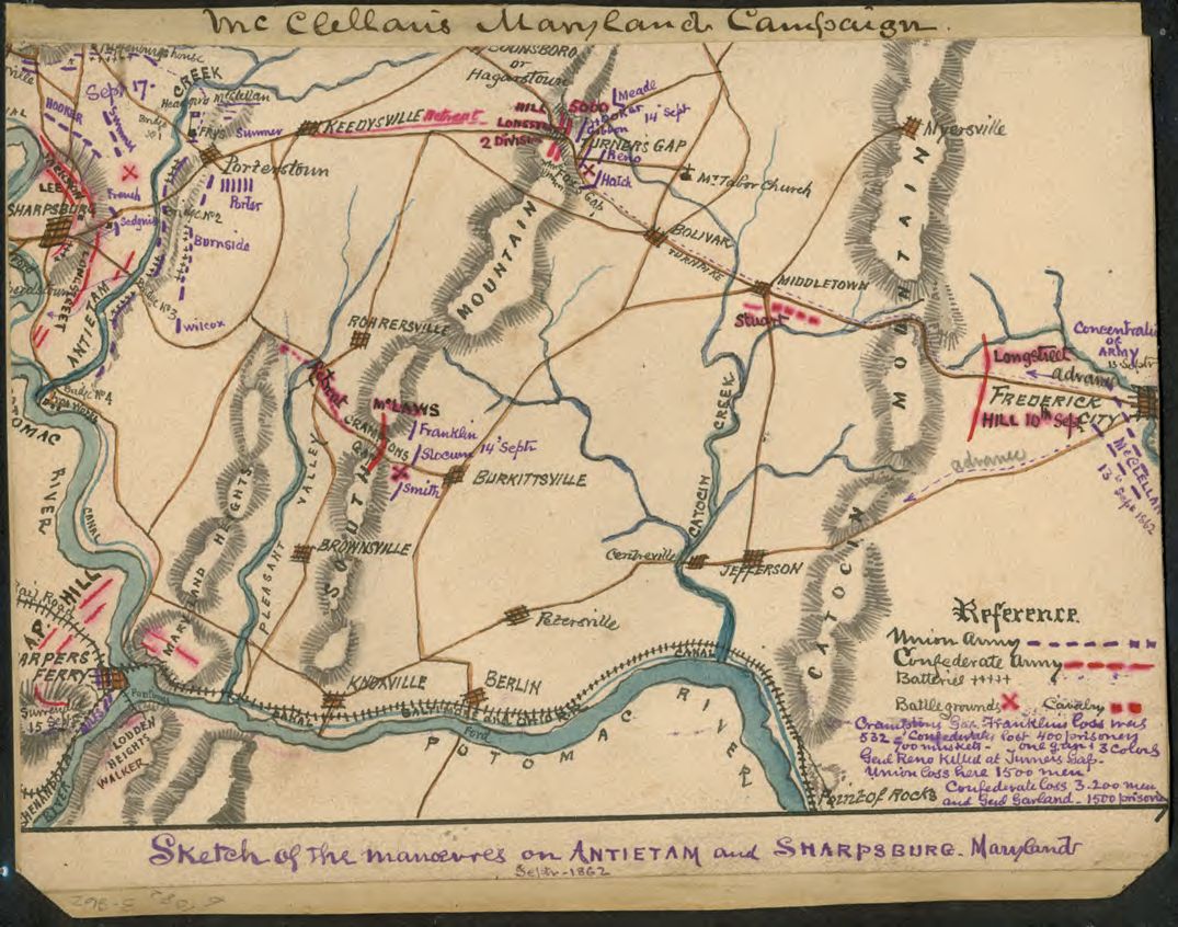

Sketch of the manoeuvres (sic) on Antietam and Sharpsburg, Maryland. Septr 1862.
Shows the area from Sharpsburg east to Frederick, Md., and the positions of Lee's Confederate army as it faced McClellan's forces. The map also shows Hagerstown south to the Potomac River. The Baltimore and Ohio Railroad is also indicated.
- Date
- 1862
- Mapmaker / publisher
- Sneden, Robert Knox
- Place
- Maryland
- Archive
- Library of Congress (via Wikimedia Commons)
- Type
- map
- Original size
- 1,075 × 846 pixels
Public domainsafest
Reason: its maker died more than 100 years ago.
Read from: Commons licence category: PD-old-100-expired; no CC BY, CC BY-SA, GFDL or deletion tag on the file page.
Credit line
"Sketch of the manoeuvres (sic) on Antietam and Sharpsburg, Maryland. Septr 1862." (1862). Sneden, Robert Knox. Library of Congress, Geography and Map Division, via Wikimedia Commons. Public domain. https://commons.wikimedia.org/wiki/File:Sketch_of_the_manoeuvres_(sic)_on_Antietam_and_Sharpsburg,_Maryland._Septr_1862._LOC_gvhs01.vhs00119.jpgNeed maps for a whole project? Add Find Any Map to Claude and ask for this one by its id: 1285.
More like this

Sketch of manoeuvers (sic) on Antietam and Sharpsburg Maryland - Septr 16-17th 1862.
September 16, 1862 · Library of Congress

Plan of the Battle of Antietam, Maryland. Sept 1862
September 16, 1862 · Library of Congress

Battle of the Antietam.
September 17, 1862 · Library of Congress

The Antietam Campaign - Sept. 1862
1862 · Library of Congress

Plan of the Battle of Antietam, Maryland.
1862 · Library of Congress

Map of the position at Turner's Gap. South Mountain.
September 14, 1862 · Library of Congress

Map showing vicinity of battlefield of Antietam Md.
1862 · Library of Congress

Battle of Crampton's Gap, Maryland - fought Septr 14th 1862.
September 14, 1862 · Library of Congress