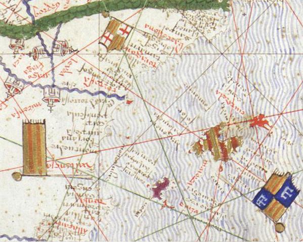

Senyeres atlas de Cresques
Detail of the Catalan Atlas of 1375. Names are written head down on the photo, because of the way they are written following the coastline.
- Date
- 1375
- Place
- the Balearic Islands
- Archive
- Wikimedia Commons
- Type
- atlas page
- Original size
- 599 × 479 pixels
Public domainsafest
Reason: its maker died more than 100 years ago.
Read from: Commons licence category: PD-old-100-expired; no CC BY, CC BY-SA, GFDL or deletion tag on the file page.
Credit line
"Senyeres atlas de Cresques" (1375). Wikimedia Commons. Public domain. https://commons.wikimedia.org/wiki/File:Senyeres_atlas_de_Cresques.jpgNeed maps for a whole project? Add Find Any Map to Claude and ask for this one by its id: 137475.
More like this

Atlas catalan de 1375
1375 · 5 sheets

Jong (Javanese junk), Java island, and other Indonesian Island in modern reproduction of Catalan atlas
14th century · Wikimedia Commons

Eastern Mediterranean detail of portolan chart of Guillem Soler (c.1380, Paris)
c. 1380 · Wikimedia Commons

Petrus Roselli. Carte marine de la mer Méditerranée et de la mer Noire (15th century)
Wikimedia Commons

Map of Angelino Dulcert upside-down
1339 · Wikimedia Commons

1413 Portolan chart by Mecia de Viladestes - Carte marine de l'océan Atlantique Nord-Est, de la mer Méditerranée, de la mer Noire, de la mer Rouge, d'une partie de la mer Caspienne, du golfe Persique et de la mer Baltique
1413 · Wikimedia Commons

Abraham and Jehuda Cresques Catalan Atlas. Eastern Europe
1375 · Wikimedia Commons