

Scan from Johann Christoph Brotze's book Sammlung verschiedner Liefländischer Monumente. Plan von denen See-Schlachten welche zwischen den Russisch Kays. und Königl. Schwedischen Kriegs Flotten am 3 t
- Date
- 1790
- Place
- Estonia
- Archive
- Wikimedia Commons
- Type
- map
- Original size
- 640 × 359 pixels
Public domain
Reason: its maker died long enough ago that the copyright has expired.
This status rests on the map's publication history, as researched by Wikimedia Commons. Check it before commercial use.
Read from: Commons licence category: PD Old; no CC BY, CC BY-SA, GFDL or deletion tag on the file page.
Credit line
"Scan from Johann Christoph Brotze's book Sammlung verschiedner Liefländischer Monumente. Plan von denen See-Schlachten welche zwischen den Russisch Kays. und Königl. Schwedischen Kriegs Flotten am 3 t" (1790). Wikimedia Commons. Public domain. https://commons.wikimedia.org/wiki/File:Bm04132abm.jpgNeed maps for a whole project? Add Find Any Map to Claude and ask for this one by its id: 250912.
More like this
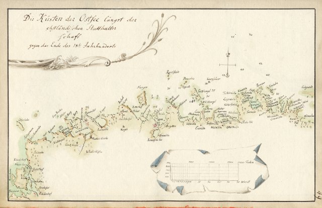
Scan from Johann Christoph Brotze's book Sammlung verschiedner Liefländischer Monumente. Die Küsten der Ostsee längst der ehstländischen Statthalterschaft gegen das Ende des 18-ten Jahrhunderts
Wikimedia Commons

Scan from Johann Christoph Brotze's book Sammlung verschiedner Liefländischer Monumente. De Zeekusten van Lyflandt van Wolfsoort tot Narva Liefland; die Karte.
Wikimedia Commons

Scan from Johann Christoph Brotze's book Sammlung verschiedner Liefländischer Monumente. Baltischportsche Kreis die Karte.
Wikimedia Commons

Scan from Johann Christoph Brotze's book Sammlung verschiedner Liefländischer Monumente. Darstellung der neuen- auf Kaiser. Befehl i. J. 1783 errichteten Revalschen u. Rigischen Statthalterschaften …
1783 · Wikimedia Commons

Scan from Johann Christoph Brotze's book Sammlung verschiedner Liefländischer Monumente. Liefland oder die beiden Herzogthümer Lief und Ehstland. die Karte.
Wikimedia Commons

Scan from Johann Christoph Brotze's book Sammlung verschiedner Liefländischer Monumente. Eintheilung Estlands bey Errichtung der Revalschen Statthalterschafft im Jahr 1783 die Karte.
1783 · Wikimedia Commons

Scan from Johann Christoph Brotze's book Sammlung verschiedner Liefländischer Monumente. Der Revalsche Kreis. 1785 die Karte.
1785 · Wikimedia Commons

Scan from Johann Christoph Brotze's book Sammlung verschiedner Liefländischer Monumente. Der Hapsalsche Kreis die Karte.
Wikimedia Commons