

SavoJapaneseChart
- Archive
- Wikimedia Commons
- Type
- map
- Original size
- 640 × 866 pixels
Public domainsafest
Reason: a US government work.
Read from: Commons licence category: PD US Government; no CC BY, CC BY-SA, GFDL or deletion tag on the file page.
Credit line
"SavoJapaneseChart". Wikimedia Commons. Public domain. https://commons.wikimedia.org/wiki/File:SavoJapaneseChart.jpgNeed maps for a whole project? Add Find Any Map to Claude and ask for this one by its id: 24914.
More like this

SavoIslandMap1
Wikimedia Commons

SavoIslandMap2
Wikimedia Commons
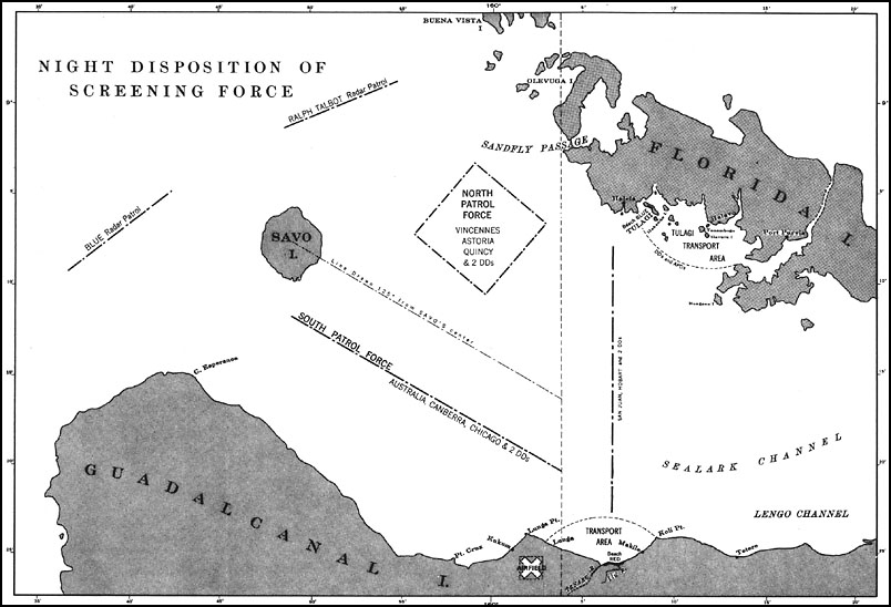
U.S. Navy map from 1943 showing disposition of Allied ships before Battle of Savo Island, 8-9 August 1942.
1943 · Wikimedia Commons

Battle of Savo Island map - disposition of forces
1980 · Wikimedia Commons

map of Battle of Cape Esperance
1946 · Wikimedia Commons

New Georgia Group 1943
1943 · Wikimedia Commons

Schlacht von Cape Esperance
Wikimedia Commons

The Solomon Islands - 1943
1943 · Wikimedia Commons