

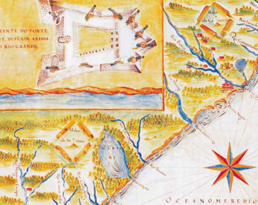
São Luis do Maranhão em mapa de 1629 por Albernaz I
- Date
- 1629
- Place
- Brazil
- Archive
- Wikimedia Commons
- Type
- map
- Original size
- 746 × 685 pixels
Public domainsafest
Reason: its maker died more than 100 years ago, and a faithful scan of a flat work adds no new copyright.
Read from: Commons licence category: PD-Art (PD-old-100); no CC BY, CC BY-SA, GFDL or deletion tag on the file page.
Credit line
"São Luis do Maranhão em mapa de 1629 por Albernaz I" (1629). Wikimedia Commons. Public domain. https://commons.wikimedia.org/wiki/File:S%C3%A3o_Luis_do_Maranh%C3%A3o_em_mapa_de_1629_por_Albernaz_I.PNGNeed maps for a whole project? Add Find Any Map to Claude and ask for this one by its id: 141619.
More like this

Description of the State of Brazil
1612 · Wikimedia Commons

Planta norte da cidade do Salvador - Bahia
1612 · Wikimedia Commons
Detail of an early 17th-century map of Rio Grande do Norte in colonial Brazil showing the Reis Magos Fortress
c. 1616 · Wikimedia Commons

Siará 1629 por Albernaz
1629 · Wikimedia Commons

Planta da Restituição da BAHIA, por João Teixeira Albernaz, capitania de Portugal
1631 · Wikimedia Commons

Mapa da baía de Paranaguá 1
1653 · Wikimedia Commons

Bahía, 1625, por João Teixeira Albernaz, plataforma de D. Manuel de Meneses
1630 · Wikimedia Commons

View of Sao Luis de Maranhao
c. 1665 · Wikimedia Commons