

Routes to Berlin
Map that show the options of routes to be followed by the Western Allies to get to Berlin
- Date
- June 21, 1943
- Mapmaker / publisher
- Robert M. Chapin
- Place
- Europe
- Archive
- Wikimedia Commons
- Type
- map
- Original size
- 960 × 1,240 pixels
Public domainsafest
Reason: its US copyright was not renewed (published 1931–1963).
Read from: Commons licence category: PD US not renewed; no CC BY, CC BY-SA, GFDL or deletion tag on the file page.
Credit line
"Routes to Berlin" (June 21, 1943). Robert M. Chapin, via Wikimedia Commons. Public domain. https://commons.wikimedia.org/wiki/File:Routes_to_Berlin.jpgNeed maps for a whole project? Add Find Any Map to Claude and ask for this one by its id: 23729.
More like this

One war, seven fronts
June 19, 1944 · Wikimedia Commons

Invasion coastline
August 10, 1942 · Wikimedia Commons

Target Tokyo
March 9, 1942 · Wikimedia Commons

Map of AAF Ferrying command transport routes, June 1942 (before the first runway at Kindley Field in the British Imperial fortress of Bermuda became active in 1943).
1942 · Wikimedia Commons

Axis double pincers, 1942
January 5, 1942 · Wikimedia Commons

Europe - September 11, 1939
September 18, 1939 · Wikimedia Commons

Territorial decisions taken in the Yalta Conference and frontlines during the conference
March 28, 1955 · Wikimedia Commons
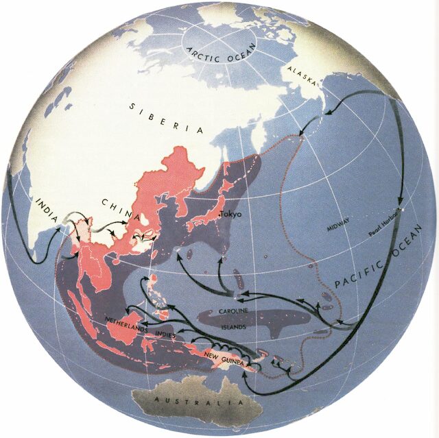
Map shows Allied attack routes against Japan in World War II
1945 · Wikimedia Commons