

Roman Empire 270
Map of the Roman Empire at 270 AD
- Date
- November 2, 2011
- Mapmaker / publisher
- O.Mustafin
- Place
- the Roman Empire
- Archive
- Wikimedia Commons
- Type
- map
- Original size
- 1,835 × 990 pixels
CC0safest
Reason: CC0: dedicated to the public domain.
Read from: Commons licence category: CC-Zero; no CC BY, CC BY-SA, GFDL or deletion tag on the file page.
Credit line
"Roman Empire 270" (November 2, 2011). O.Mustafin, via Wikimedia Commons. CC0. https://commons.wikimedia.org/wiki/File:Roman_Empire_270.pngNeed maps for a whole project? Add Find Any Map to Claude and ask for this one by its id: 20565.
More like this
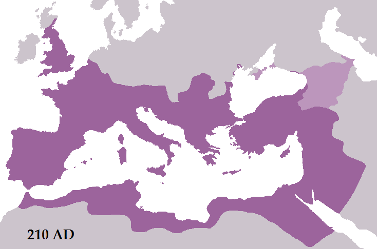
The Roman Empire in 210 AD after the conquests of emperor Septimius Severus. Roman territory is dark purple, Roman dependencies are in light purple. There are two areas of Roman dependencies: the Bosp
December 25, 2010 · Wikimedia Commons

Map of of the Roman Empire, from the Small Brockhaus and Efron Encyclopedic Dictionary, 2nd ed., vol. 2, book 4, between columns 1200 and 1201 (pages in file: 78-79).
1909 · Wikimedia Commons

Roman Empire full map
Wikimedia Commons

Roman Empire
1907 · Wikimedia Commons

Roman Empire at peak
February 21, 2024 · Wikimedia Commons

Roman empire at its greatest extent
1856 · Wikimedia Commons

The Roman Empire in 500 AD.
October 17, 2011 · Wikimedia Commons

RomanEmpire large
2008–2010 · Wikimedia Commons