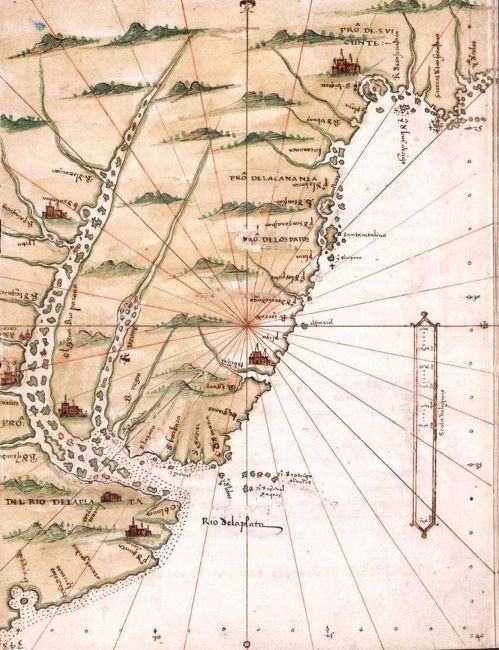

Rio de la plata- Alonso de Santa Cruz
- Mapmaker / publisher
- Alonso de Santa Cruz (1505-1567)
- Place
- Argentina
- Archive
- Wikimedia Commons
- Type
- map
- Original size
- 499 × 650 pixels
Public domain
Reason: its maker died long enough ago that the copyright has expired.
This status rests on the map's publication history, as researched by Wikimedia Commons. Check it before commercial use.
Read from: Commons licence category: PD Old; no CC BY, CC BY-SA, GFDL or deletion tag on the file page.
Credit line
"Rio de la plata- Alonso de Santa Cruz". Alonso de Santa Cruz (1505-1567), via Wikimedia Commons. Public domain. https://commons.wikimedia.org/wiki/File:Rio_de_la_plata-_Alonso_de_Santa_Cruz.jpgNeed maps for a whole project? Add Find Any Map to Claude and ask for this one by its id: 305793.
More like this

Map of the Caribbean Islands (Puerto Rico) and Central America
Wikimedia Commons

Mapa del Río de la Plata - parte
1692 · Wikimedia Commons

Map of the mouth of the Rio de Plata
1631 · Wikimedia Commons

Atlas nautique du monde composé de sept cartes manuscrites sur vélin / signé Joan Martines en Messina, anny 1582
1582 · South America, plate 11 of 16

Martines Atlas 1591 (05 of 14) Southwestern South America
1591 · Wikimedia Commons

A Chart of the river Plate from the bay of Castillos to Santa Fe. Done from the latest et Best Discoveries / by order ye. order of ye. Honble. South Sea Company
Wikimedia Commons

Campana de Roldán
1529 · Wikimedia Commons

El Reino de Chile y la Gobernación del Río de la Plata (1592) - AHG
1592 · Wikimedia Commons