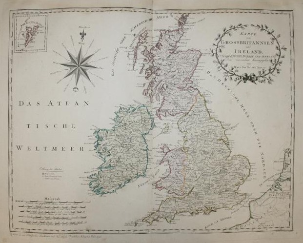

Reilly Karte von Grossbritannien und Ireland
- Date
- 1794–1796
- Mapmaker / publisher
- Stecher: Hieronymus Benedicti
- Place
- the British Isles
- Archive
- Wikimedia Commons
- Type
- atlas page
- Original size
- 621 × 498 pixels
Public domainsafest
Reason: its maker died more than 100 years ago, and a faithful scan of a flat work adds no new copyright.
Read from: Commons licence category: PD-Art (PD-old-100); no CC BY, CC BY-SA, GFDL or deletion tag on the file page; permission field: PD-art.
Credit line
"Reilly Karte von Grossbritannien und Ireland" (1794–1796). Stecher: Hieronymus Benedicti, via Wikimedia Commons. Public domain. https://commons.wikimedia.org/wiki/File:Reilly_Karte_von_Grossbritannien_und_Ireland.jpgNeed maps for a whole project? Add Find Any Map to Claude and ask for this one by its id: 244771.
More like this

Karte von Grossbritannien und Ireland, nach Kitchin, Dorret und Jefferys
1795 · Wikimedia Commons

Reilly Allgemeiner Postatlas Schottland, Irland
1799 · Wikimedia Commons

Map of England in 1791 by Reilly 079b
1791 · Wikimedia Commons

The British Isles, comprehending Great Britain and Ireland; with the adjacent islands
1788 · New York Public Library

Karte von Scotland, nach Dorret
1795 · Wikimedia Commons

Charte der vereinigten Königreiche Grosbritanien und Ireland, nach den neuesten Berichtigungen und astronomischen Ortsbestimmungen entworfen auf der Sternwarte Seeberg, bey Gotha
Wikimedia Commons

Regnorum Magnae Britanniae Et Hiberniae Mappa Geographica
1749 · Wikimedia Commons

Map of the United Kingdom in 1791 by Reilly 078
1791 · Wikimedia Commons