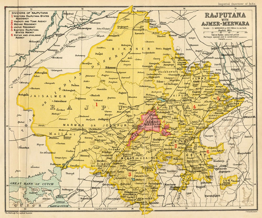

Rajputana 1909
From "Imperial Gazetteer of India", 1907-1909. Category:History of Rajasthan
- Date
- 1909
- Place
- Rajasthan
- Archive
- Wikimedia Commons
- Type
- map
- Original size
- 1,000 × 831 pixels
Public domainsafest
Reason: its US copyright has expired (published before 1931).
Read from: Commons licence category: PD US expired; no CC BY, CC BY-SA, GFDL or deletion tag on the file page; permission field: published by erstwhile Imperial Gazetteer of India almost 100 years ago..
Credit line
"Rajputana 1909" (1909). Wikimedia Commons. Public domain. https://commons.wikimedia.org/wiki/File:Rajputana_1909.jpgNeed maps for a whole project? Add Find Any Map to Claude and ask for this one by its id: 257120.
More like this

Political Divisions of the Indian Empire, 1909
1909 · Wikimedia Commons

1909 Imperial Gazetteer of India Rajputana map section
1909 · Wikimedia Commons

NWBritish Indian Empire1909
1909 · Wikimedia Commons

Bikaner-Jaisalmer map
1909 · Wikimedia Commons

1931 Boundaries of States in Rajputana
1931 · Wikimedia Commons

Chota Nagpur area-IGI
January 2, 1909 · Wikimedia Commons

1801 - 20 - 07(A)
1801 · Wikimedia Commons

Sirohi-Udaipur map
1909 · Wikimedia Commons