

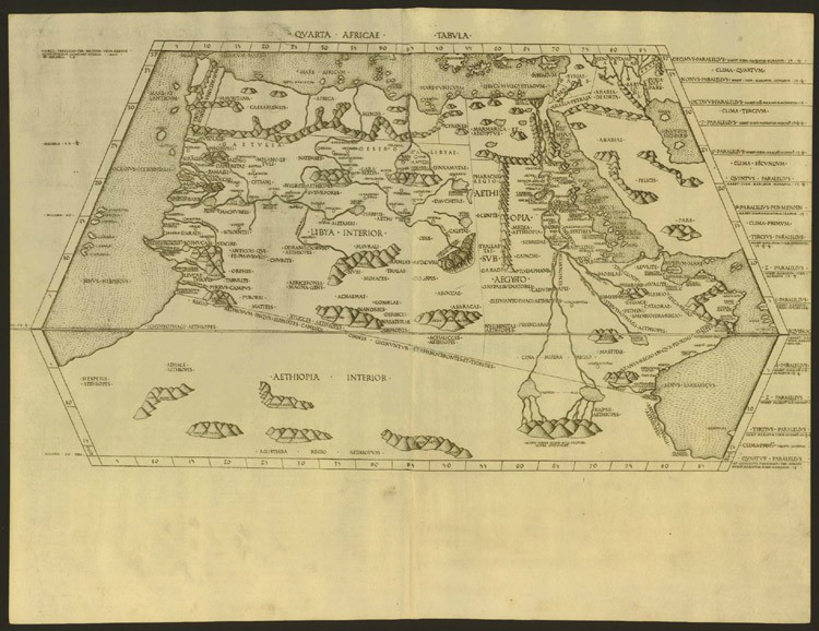
Quarta Africae Tabula
The Fourth Map of Africa (Quarta Africae Tabula), depicting Saharan Africa (Libya Interior), Ethiopia and Sudan (Aethiopia sub Aegypto), and Subsaharan Africa (Aethiopia Interior), from the edition of Ptolemy's Geography (Cosmographia) printed at Rome.
- Date
- 1478
- Mapmaker / publisher
- Ptolemy, translated by Jacobus Angelus
- Place
- Africa
- Archive
- Wikimedia Commons
- Type
- map
- Original size
- 3,200 × 2,133 pixels
Public domainsafest
Reason: its maker died more than 70 years ago.
Read from: Commons licence category: PD-old-70-expired; no CC BY, CC BY-SA, GFDL or deletion tag on the file page.
Credit line
"Quarta Africae Tabula" (1478). Ptolemy, translated by Jacobus Angelus, via Wikimedia Commons. Public domain. https://commons.wikimedia.org/wiki/File:Quarta_Africae_Tabula_(1478).jpgNeed maps for a whole project? Add Find Any Map to Claude and ask for this one by its id: 234452.
More like this
Quarta Africae Tabula
Wikimedia Commons

The Cosmography of Claude Ptolemy the Alexandrian (Cosmographia Claudii Ptolomaei Alexandrini)
1467 · Africa

Tertia Africae Tabula
1478 · Wikimedia Commons

Aphricae Tabula IIII
1552 · Wikimedia Commons

The Cosmography of Claudius Ptolemaeus the Alexandrian (Cosmographia Claudii Ptolomaei Alexandrini)
1467 · Africa

Prima Africae Tabula
1478 · Wikimedia Commons

Listed in De Ricci, Seymour, Census of Medieval and Renaissance Manuscripts in the United States and Canada. New York. N.Y.: H.W. Wilson, 1935; and Supplement, New York, N.Y.: Bibliographical Society
c. 1467 · Africa

Quarta Europe Tabula
1478 · Wikimedia Commons