

Qalaherriaiq map
Map of the northwestern coast of Greenland in the journal of Clements Markham, attributed to Inughuit interpreter Qalaherriaq.
- Date
- 1851
- Mapmaker / publisher
- Clements Markham
- Place
- Greenland
- Archive
- Wikimedia Commons
- Type
- map
- Original size
- 1,013 × 1,293 pixels
Public domainsafest
Reason: public domain: US unpublished.
Read from: Commons licence category: PD US unpublished; no CC BY, CC BY-SA, GFDL or deletion tag on the file page.
Credit line
"Qalaherriaiq map" (1851). Clements Markham, via Wikimedia Commons. Public domain. https://commons.wikimedia.org/wiki/File:Qalaherriaiq_map.jpgNeed maps for a whole project? Add Find Any Map to Claude and ask for this one by its id: 294369.
More like this

Map of Greenland
January 4, 1737 · Wikimedia Commons

Carta-ofver-grønlands vesterside-hans-egede-1724
1724 · Wikimedia Commons

Greenland Icefields (1896) Fig 49
1896 · Wikimedia Commons

MAJOR(1874) p67 Map of Greenland
1875 · Wikimedia Commons

Map of the Crown Prince Islands, Disco (sic) Bay, Greenland
1925 · Library of Congress

Map of Greenland, 1685
1685–1719 · Wikimedia Commons
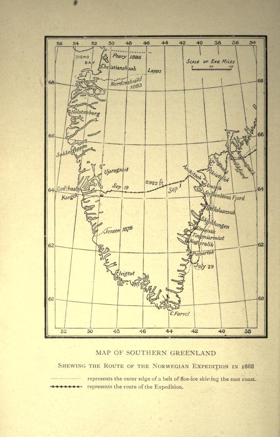
Map showing route of Nansen's first crossing of Greenland, 1888
1888 · Wikimedia Commons

German Arctic Expedition of 1869-70, and Narrative of the Wreck of the 'Hansa' in the Ice
1874 · Wikimedia Commons