

Public Schools Historical Atlas - Roman Empire 4th century
Map of Roman Empire in 4th century.
- Date
- 1905
- Mapmaker / publisher
- Charles Colbeck * Edited by Yarl
- Place
- the Roman Empire
- Archive
- Wikimedia Commons
- Type
- atlas page
- Original size
- 1,622 × 1,269 pixels
Public domain
Reason: a US government work.
This status rests on the map's publication history, as researched by Wikimedia Commons. Check it before commercial use.
Read from: Commons licence category: PD US; no CC BY, CC BY-SA, GFDL or deletion tag on the file page.
Credit line
"Public Schools Historical Atlas - Roman Empire 4th century" (1905). Charles Colbeck * Edited by Yarl, via Wikimedia Commons. Public domain. https://commons.wikimedia.org/wiki/File:Public_Schools_Historical_Atlas_-_Roman_Empire_4th_century.jpgNeed maps for a whole project? Add Find Any Map to Claude and ask for this one by its id: 19802.
More like this

The Roman Empire from Diocletian to the death of Theodosius (285-395 A.D.)
1902 · Wikimedia Commons

Imperio Romano
1899 · Wikimedia Commons
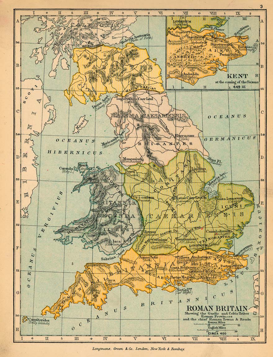
Roman britain 400
1905 · Wikimedia Commons

Historical atlas of modern Europe: from the decline of the Roman Empire: comprising also maps of parts of Asia, Africa, and the New World connected with Europaean history
Wikimedia Commons

PELHAM(1895) p496 MAP 4
1895 · Wikimedia Commons

C. 395 Roman Provinces
c. 1911 · Wikimedia Commons

F.W. Putzgers Historischer Schul-Atlas: zur alten, mittleren und neuen Geschichte: in 66 Haupt- und 63 Nebenkarten
Wikimedia Commons

Map of of the Roman Empire, from the Small Brockhaus and Efron Encyclopedic Dictionary, 2nd ed., vol. 2, book 4, between columns 1200 and 1201 (pages in file: 78-79).
1909 · Wikimedia Commons