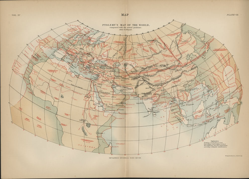

Ptolemy's Map of the World Compared with the Actual Positions
A world map on Ptolemy's second projection, with the geographical information from Ptolemy's Geography in red and 19th-century corrections in black. Dotted lines show displacements according to H. Kiepert's identifications.
- Date
- 1883
- Archive
- Wikimedia Commons
- Type
- map
- Original size
- 1,000 × 718 pixels
Public domain
Reason: a US government work.
This status rests on the map's publication history, as researched by Wikimedia Commons. Check it before commercial use.
Read from: Commons licence category: PD US; no CC BY, CC BY-SA, GFDL or deletion tag on the file page.
Credit line
"Ptolemy's Map of the World Compared with the Actual Positions" (1883). Wikimedia Commons. Public domain. https://commons.wikimedia.org/wiki/File:Ptolemy%27s_Map_of_the_World_Compared_with_the_Actual_Positions.jpgNeed maps for a whole project? Add Find Any Map to Claude and ask for this one by its id: 145738.
More like this

PSM V16 D508 Map of ptolemy 150 ad
1879–1880 · Wikimedia Commons

Claudius Ptolemy's world, cir. A. D. 150
1897 · Wikimedia Commons

Orbis Terrarum ad Mentem Ptolemaei
Wikimedia Commons

EB 1911 Ptolemy's Map
c. 1911 · Wikimedia Commons

EB9 Vol XV Pl VII Ptolemy's Map of the World
1883 · Wikimedia Commons

Ptolomaei Cognita
1574 · 2 sheets

Orbis Ptolomaei
1907 · Wikimedia Commons

Universalis Tabula Iuxta Ptolemaeum
1576–1618 · Wikimedia Commons