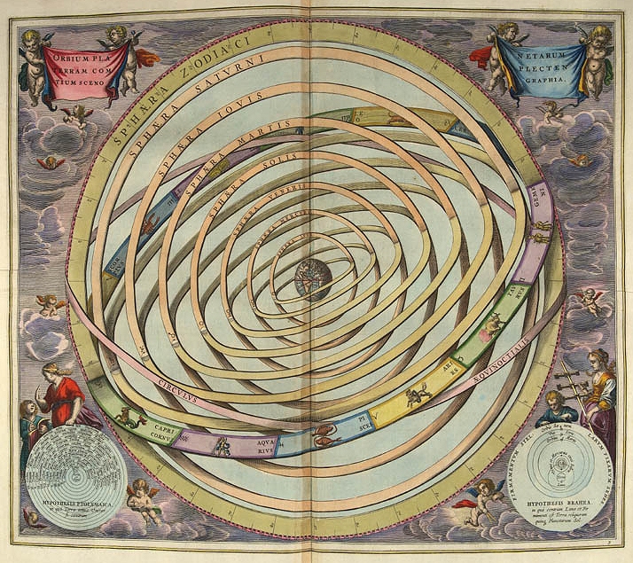

Ptolemaic orbits, from "Harmonia Macrocosmica" by Andreas Cellarius, 1661.
- Date
- February 24, 2005
- Archive
- Wikimedia Commons
- Type
- atlas page
- Original size
- 714 × 635 pixels
Public domain
Reason: a US government work.
This status rests on the map's publication history, as researched by Wikimedia Commons. Check it before commercial use.
Read from: Commons licence category: PD US; no CC BY, CC BY-SA, GFDL or deletion tag on the file page; permission field: This image is in the public domain; PD-US; PD-ART.; Commons tags it as a US government work, but its record names no government maker.
Credit line
"Ptolemaic orbits, from "Harmonia Macrocosmica" by Andreas Cellarius, 1661." (February 24, 2005). Wikimedia Commons. Public domain. https://commons.wikimedia.org/wiki/File:Ptolemaic-geocentric-model.jpgNeed maps for a whole project? Add Find Any Map to Claude and ask for this one by its id: 103883.
More like this

1660 geocentric model chart - Scenographia Systematis Mundani Ptolemaici
1660 · Wikimedia Commons

Andreas Cellarius' Harmonia Macrocosmica
1660–1708 · Wikimedia Commons

Scenographia systematis mvndani Ptolemaici cartographic material. *Publisher: Amsterdam: s.n., 1660 *Physical Description: 1 map: col.; 38 cm. in diam. *Notes: "444" in top right hand margin in pencil. Rex Nan Kivell Collection Map NK 10241.
1660 · Wikimedia Commons

Map from the 1708 Valk & Schenk edition of Andreas Cellarius' Harmonia Macrocosmica.
1660–1708 · 3 sheets

Atlas Coelestis seu Harmonia Macrocosmica (Celestial Atlas)
1660–1708 · Wikimedia Commons

Atlas Coelestis. Harmonia Macrocosmica seu Atlas
1660–1708 · Wikimedia Commons

Harmonia Macrocosmica Star Atlas, Andreas Cellarius,1660
1660–1708 · Wikimedia Commons

Theoria Lunae, Eius Motum Per Eccentricum Et Epicyclum Demonstrans
1660–1708 · Wikimedia Commons