

Ptolemaic Europe
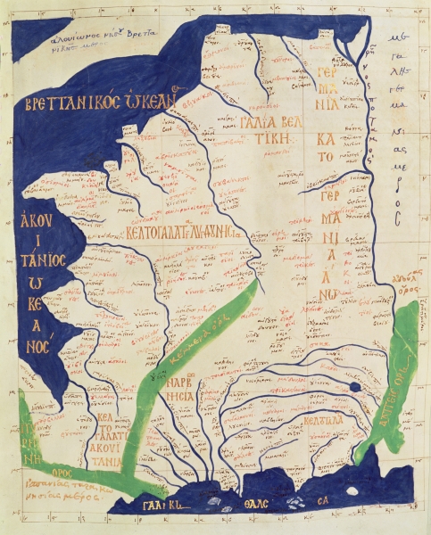
A map combining the various regional maps of Europe from the Vatican Library's MS Urb. Gr. 83, folios 112 verso & 113 recto, a 15th-century Greek manuscript of Ptolemy's Geography
- Mapmaker / publisher
- Ptolemy
- Place
- Europe
- Archive
- Library of Congress (via Wikimedia Commons)
- Type
- map
- Original size
- 2,119 × 1,519 pixels
Public domain
Reason: its maker died more than 100 years ago, and a faithful scan of a flat work adds no new copyright.
This status rests on the map's publication history, as researched by Wikimedia Commons. Check it before commercial use.
Read from: Commons licence category: PD-Art (PD-old-100); no CC BY, CC BY-SA, GFDL or deletion tag on the file page.
Credit line
"Ptolemaic Europe". Ptolemy. Library of Congress, Geography and Map Division, via Wikimedia Commons. Public domain. https://commons.wikimedia.org/wiki/File:Ptolemaic_Europe.jpgNeed maps for a whole project? Add Find Any Map to Claude and ask for this one by its id: 20278.
More like this

The Cosmography of Claudius Ptolemaeus of Alexandria (Cosmographia Claudii Ptolomaei Alexandrini)
1467 · Wikimedia Commons

Europe Tabula Prima
1426 · Wikimedia Commons

The Cosmography of Claude Ptolemy the Alexandrian (Cosmographia Claudii Ptolomaei Alexandrini)
1467 · Wikimedia Commons

Prima Europe Tabula
1478 · Wikimedia Commons

A collection of maps, in Greek, after Ptolemy's Geographia
Ptolemy | date = 1420

Cosmography (Cosmographia Claudii Ptolomaei Alexandrini)
1467 · Wikimedia Commons
Keltogalatias kai Galia Beltike kai Germanias Kato kai Ano
Wikimedia Commons

Listed in De Ricci, Seymour, Census of Medieval and Renaissance Manuscripts in the United States and Canada. New York. N.Y.: H.W. Wilson, 1935; and Supplement, New York, N.Y.: Bibliographical Society
1460 · New York Public Library